Tartary · Tartarie · Tartaria Magna · Great Tartary
Read this first
Introduction
Tartaria - also Tartary, Tartarie, Tartarey, Tartere, Tartaria Magna or Great Tartary - lives two lives. One is real: for six centuries it was Europe's name for the vast, poorly known interior of Asia, from the Volga to the Pacific. The other is legendary: since about 2016 it has been the name of a supposed lost world-empire of giants, free energy and star forts, said to have been buried by a "mud flood" and erased from history in the 1800s.
This atlas follows both. Every claim is shown side by side with what the documentary record says, along with the older myths the modern story borrows from - Gog and Magog, Hyperborea, Kitezh, Shambhala, Atlantis and the Vegetable Lamb. Images are organized in folders under images/, each with its title, description, author and licence written into the page's meta tags.
Short version. Tartary was a real place-name, never a single country. It was a European umbrella label - like "the Orient" - that broke into Little, Chinese, Independent and Muscovite Tartary and then vanished as surveys replaced it with Siberia, Turkestan, Mongolia and Manchuria. The lost-empire story grew out of Russian pseudo-history (Fomenko, Levashov) and went global on YouTube and Reddit. No archaeological, documentary or geological evidence supports it - but its questions about lost craftsmanship and demolished beauty are why it spreads.
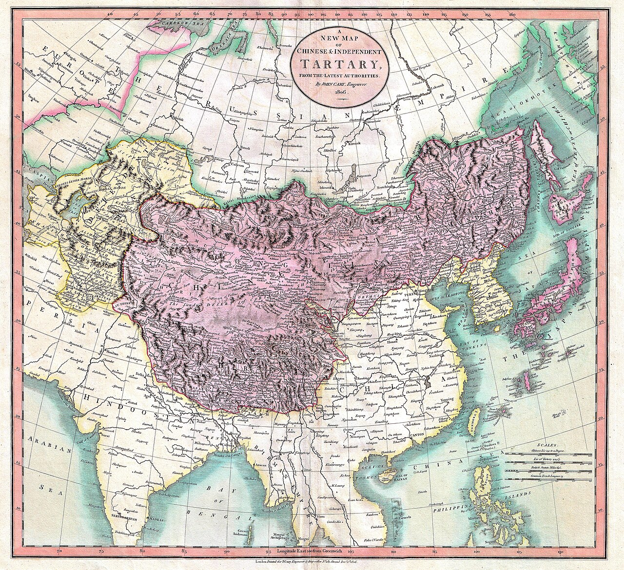
Tartary on early-modern mapsRun the image installer to download
Tartary on early-modern mapsLead illustration of the Wikipedia article on Tartary: the European name for the poorly known interior of northern and central Asia, used on maps from the 13th to the 19th century.
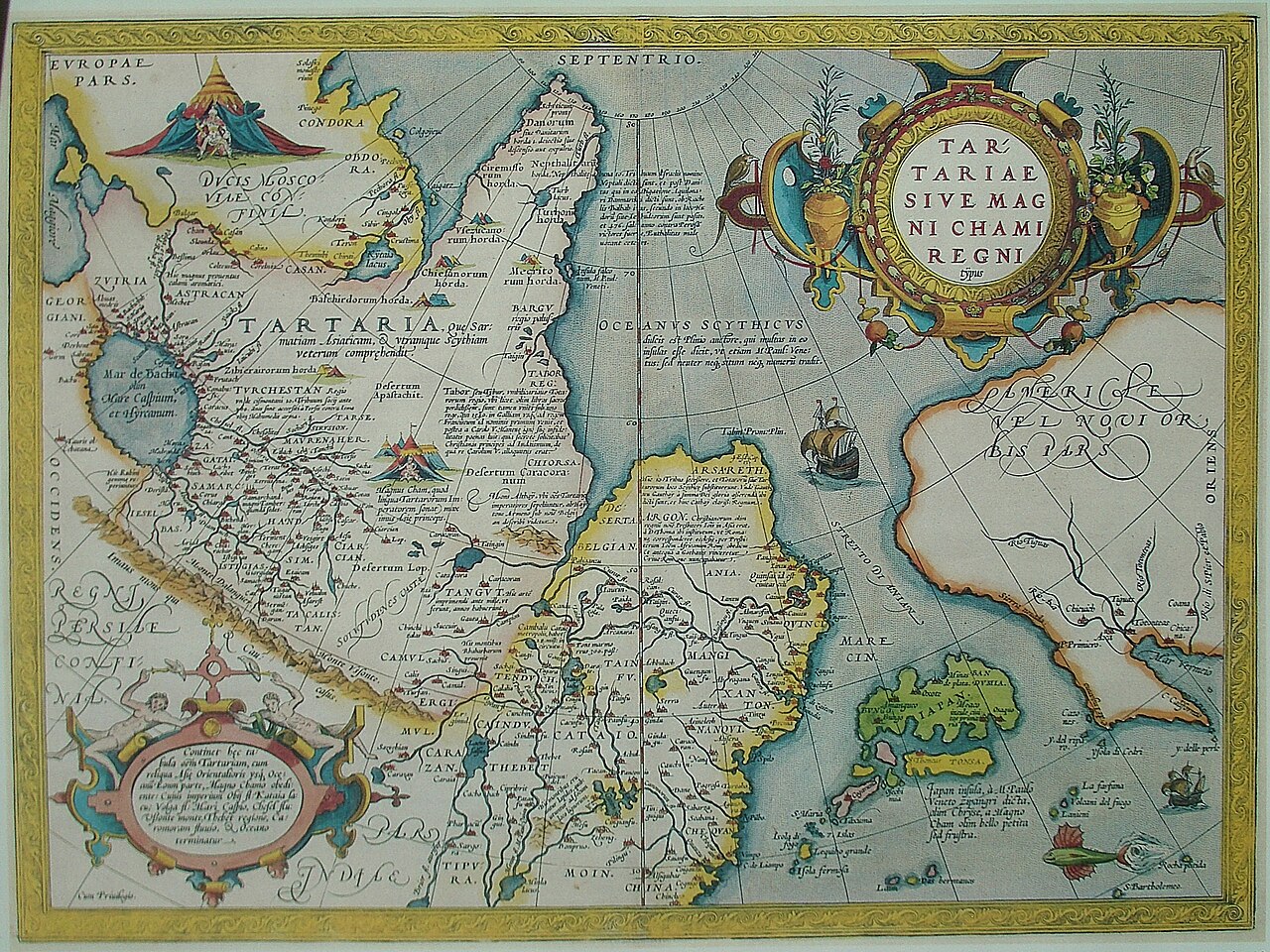
Ortelius, Tartariae sive Magni Chami Regni (1570)Run the image installer to download
Ortelius, Tartariae sive Magni Chami Regni (1570)Abraham Ortelius's 1570 map from the Theatrum Orbis Terrarum, the first atlas map dedicated to Tartary. It shows one vast region from the Volga to the Pacific, still echoing the Mongol Empire of two centuries earlier.
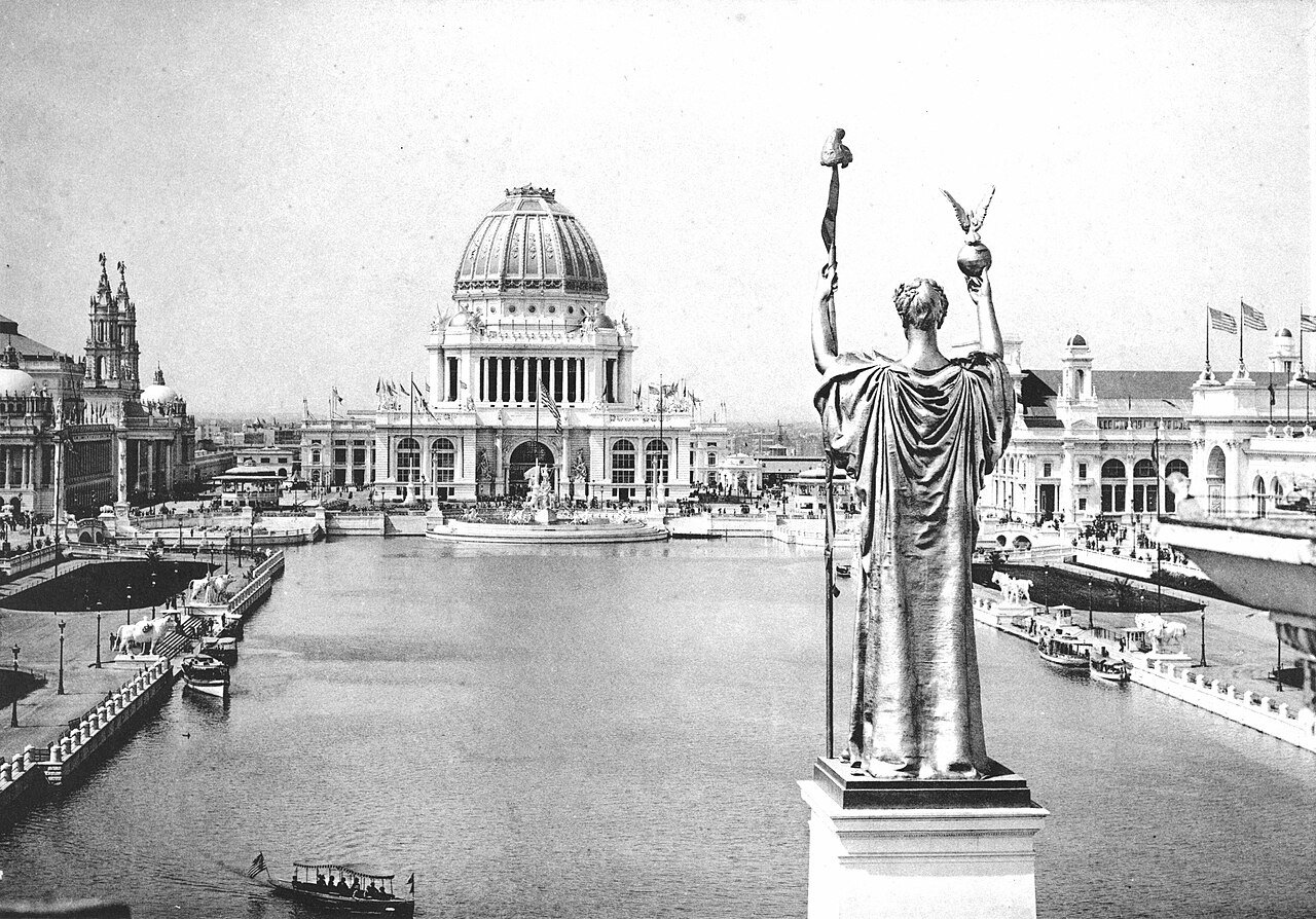
World's Columbian Exposition, Chicago (1893)Run the image installer to download
World's Columbian Exposition, Chicago (1893)Chicago's 1893 'White City': wood frames clad in staff, a plaster-and-fibre mix, built in about two years and mostly burned in 1894.
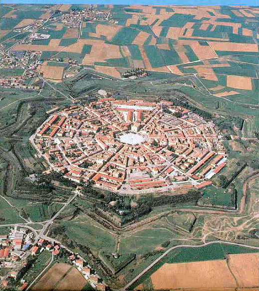
Palmanova, ItalyRun the image installer to download
Palmanova, ItalyPalmanova, a nine-pointed ideal fortress city founded by Venice in 1593 - a UNESCO site and a Tartaria favourite from aerial photos.
Tartary, Tartaria, Tartarie...
The many names
The extra "r" is the key. The people were Tatars (a Turkic and Mongol tribal name). After the Mongol invasions of 1237-1241, European writers punned it into Tartar - people from Tartarus, the Greek abyss beneath Hades. The land became Tartaria, and the label stuck to almost any inner-Asian people for 500 years.
Tartary
English. The standard name on British maps and in the 1771 Britannica.
Tartaria
Latin and Italian. Used on Ortelius, Mercator and Cantelli maps; the form most used online today.
Tartarie
French. Guillaume de L'Isle's 'Carte de Tartarie' and Jesuit reports.
Tartarey / Tartere / Tartery
Older English and Dutch spellings found in travel books and flag charts.
Tartaria Magna / Great Tartary
Siberia and the open north of Asia.
Tartaria Minor / Little Tartary
The Crimean Khanate and the steppe north of the Black Sea.
Chinese Tartary
Manchuria and Mongolia, homeland of the Qing dynasty's Manchu.
Independent / Free Tartary
Western Central Asia: today's Kazakhstan, Uzbekistan, Turkmenistan.
Muscovite / Russian Tartary
Lands of the Tatars ruled by the Russian tsar.
Tatar / Tatarstan
The real people and modern Russian republic the name grew from.
Tartarus
The Greek pit beneath Hades, the pun that added the extra 'r'.
Grand Tartar / Great Cham
European titles for the Mongol Great Khan, then any Central Asian ruler.
Mogul / Mongol
Same root; the Mughals of India descended from Timur and Genghis Khan.
Horde / Orda
Turkic word for a camp or court; Fomenko's 'Russian Horde' = his Great Tartary.
Rassenia / Slavic-Aryan Empire
Levashov's names for his version of Great Tartaria.
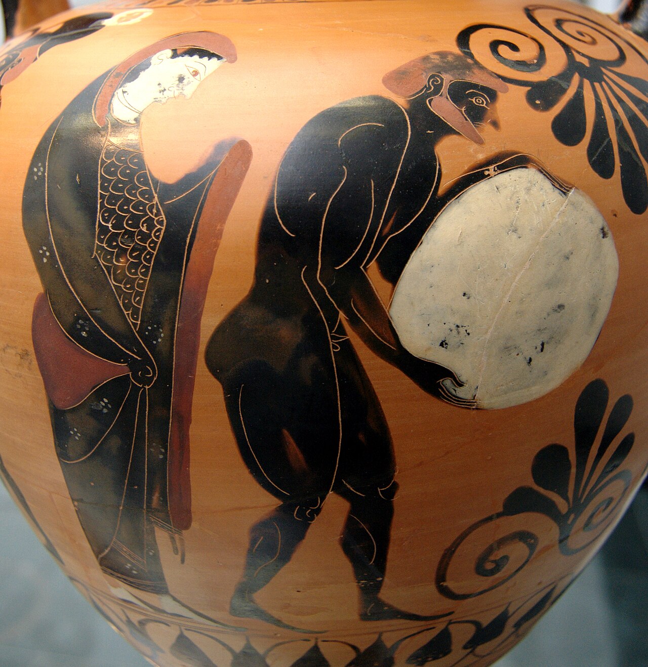
TartarusRun the image installer to download
TartarusTartarus, the abyss beneath Hades in Greek myth. Europeans punned Tatar into 'Tartar' - people from hell.
The TatarsRun the image installer to download
The TatarsThe Tatars - Volga, Crimean, Siberian and other Turkic peoples - the real people whose name Europeans stretched into 'Tartar'.
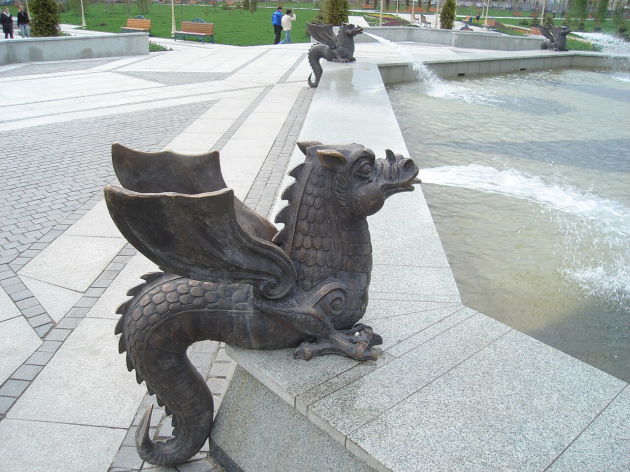
Zilant, the dragon of KazanRun the image installer to download
Zilant, the dragon of KazanZilant, the winged serpent on Kazan's coat of arms. Sometimes linked to the 'Tartarian dragon flag', though heraldists say its origin is different.
13th-19th centuries
The real Tartary
For Europeans, Tartary began as a terror and ended as a blank on the map. Friars sent by the Pope and the King of France reached the Great Khan in the 1240s-1250s and brought back the first eyewitness books. Marco Polo's account of Kublai Khan made the "Great Khan of the Tartars" a household figure. After the Mongol Empire fragmented, the khanates of the Golden Horde, Crimea, Kazan, Astrakhan and Sibir were all "Tartar" to Europe - and so, later, were the Manchu who conquered China in 1644.
Divisions of Tartary on European maps
Great Tartary
Siberia and northern Asia, east of the Urals. Became "Russian Tartary", then simply Siberia.
Little Tartary
The Crimean Khanate (1441-1783) and the Nogai steppe north of the Black Sea.
Chinese Tartary
Manchuria and Mongolia under the Qing. Replaced by "Manchuria" in the 1700s-1800s.
Independent Tartary
Western Central Asia: Khiva, Bukhara, the Kazakh steppe. Later "Turkestan".
Muscovite Tartary
Tatar lands under the tsar - Kazan and Astrakhan, conquered 1552-1556.
Timeline
Herodotus describes Scythia, griffins and the one-eyed Arimaspi on the northern steppe.
Ptolemy's Geography names the region Scythia and Serica. No 'Tartaria' yet.
Temujin is proclaimed Genghis Khan; the Mongol Empire begins its expansion.
Batu Khan's armies sweep through Rus', Poland and Hungary. Europe calls them Tartars, 'people from Tartarus'.
Papal and royal envoys Carpini and Rubruck reach the Great Khan and write the first eyewitness books on 'the Tartars'.
Marco Polo's journey; his book makes Kublai, 'the Great Khan of the Tartars', famous in Europe.
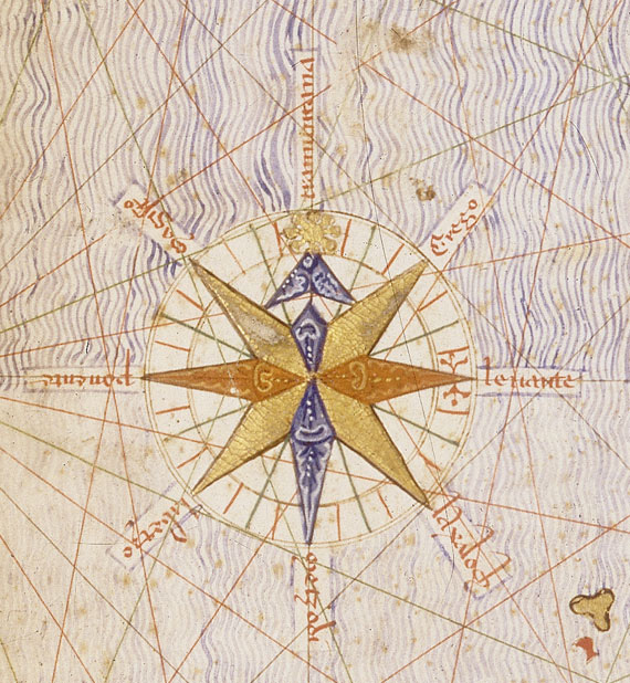
The Catalan Atlas maps the khanates, caravans and the walled lands of Gog and Magog.
The Crimean Khanate is founded - 'Little Tartary' on later maps.
Ivan IV takes Kazan (1552) and Astrakhan (1556); Yermak attacks the Khanate of Sibir (1582).
Ortelius publishes the first atlas map devoted to 'Tartaria'.
The Manchu found the Qing dynasty in China; Jesuits call them Tartars, and Manchuria 'Chinese Tartary'.
Martino Martini's De Bello Tartarico narrates the Manchu conquest.
Carel Allard's flag books print imaginative 'Tartarian' owl and dragon flags.
Strahlenberg's map of Great Tartary, drawn from Siberian captivity, shrinks the name southward.
The first Encyclopaedia Britannica calls Tartary 'a vast country in the northern parts of Asia'.
Russia annexes the Crimean Khanate; Little Tartary disappears from politics.
Explorers and surveyors replace Tartary with Siberia, Turkestan, Mongolia and Manchuria.
The name is gone from new atlases; it survives in phrases like 'catch a Tartar'.
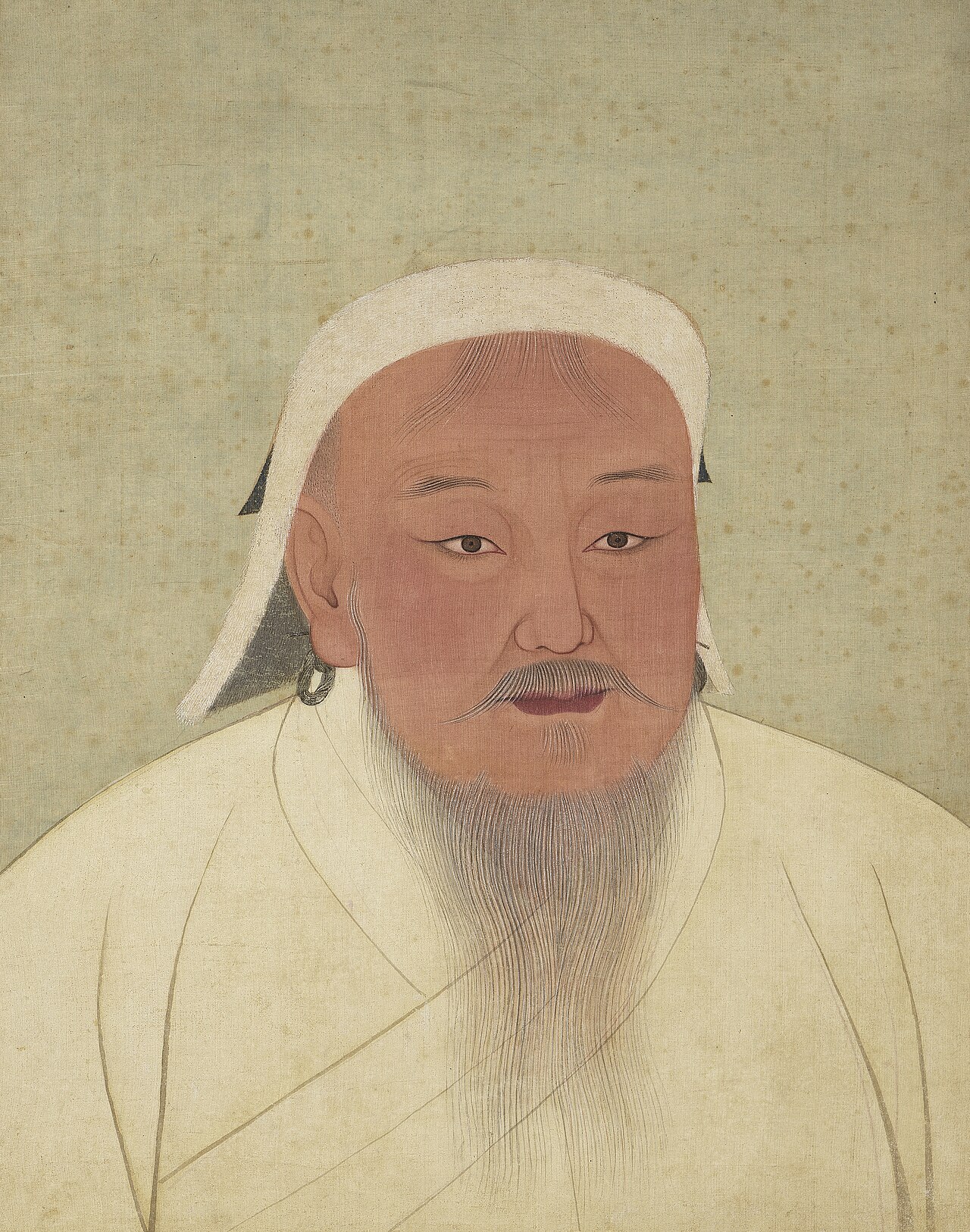
Genghis KhanRun the image installer to download
Genghis KhanYuan-era portrait of Genghis Khan (c. 1162-1227), founder of the Mongol Empire. Some Tartaria believers recast him as a Tartarian king.
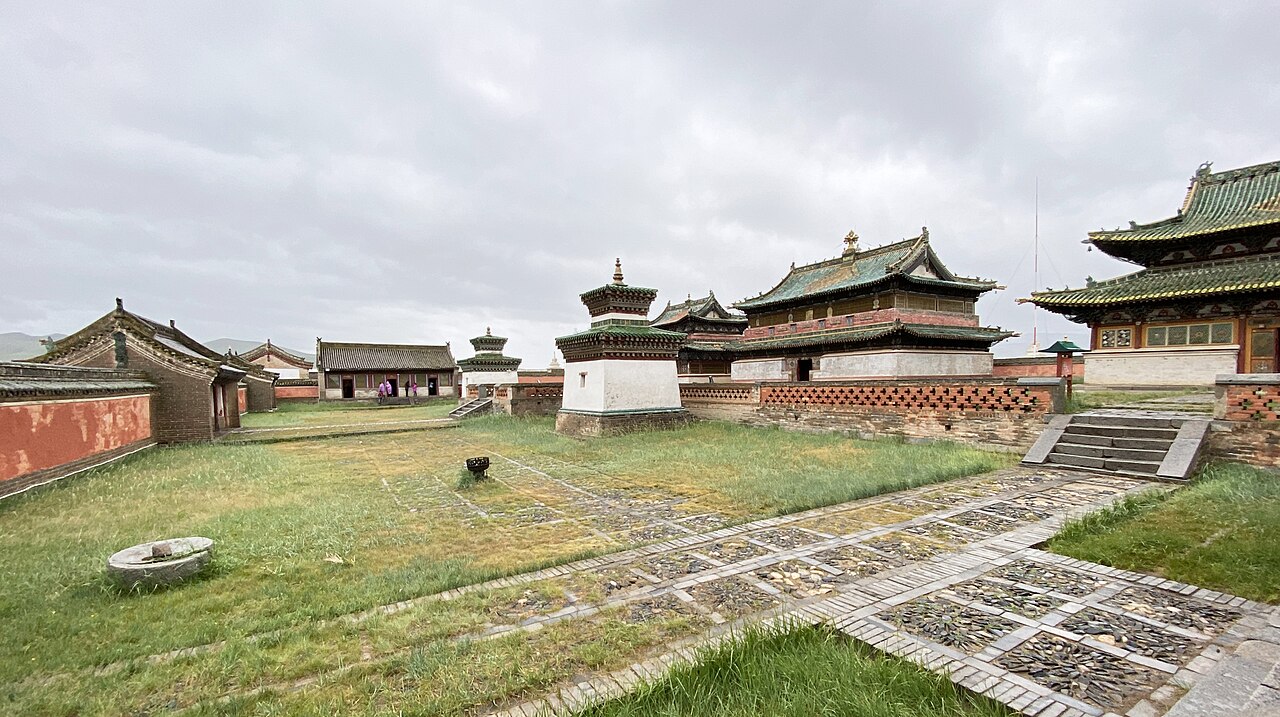
KarakorumRun the image installer to download
KarakorumKarakorum, capital of the Mongol Empire in the 13th century - the closest thing to a real 'capital of Tartary'.
The Golden HordeRun the image installer to download
The Golden HordeThe Golden Horde (Ulus of Jochi), the north-western successor khanate of the Mongol Empire, whose peoples Europeans called Tartars.
Extent of the Mongol EmpireRun the image installer to download
Extent of the Mongol EmpireMap of the Mongol Empire at its largest extent in the late 13th century - the historical reality behind Europe's 'Great Tartary'.
Crimean Khanate - 'Little Tartary'Run the image installer to download
Crimean Khanate - 'Little Tartary'The Crimean Khanate (1441-1783), known on European maps as Little Tartary.
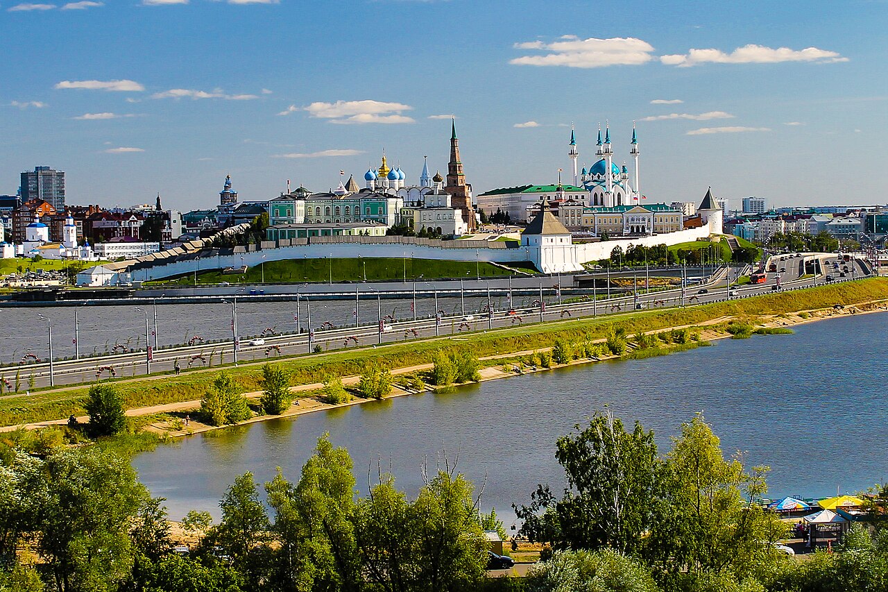
Kazan KremlinRun the image installer to download
Kazan KremlinThe Kazan Kremlin in Tatarstan, seat of the former Khanate of Kazan, conquered by Ivan the Terrible in 1552.
Manchuria - 'Chinese Tartary'Run the image installer to download
Manchuria - 'Chinese Tartary'Manchuria, homeland of the Manchu who founded China's Qing dynasty in 1644; Jesuit writers called the Manchu 'Tartars' and their homeland Chinese Tartary.
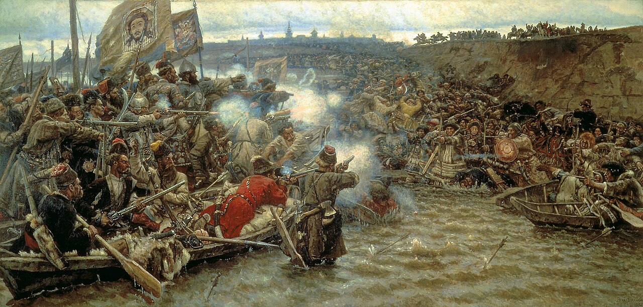
Yermak's conquest of SiberiaRun the image installer to download
Yermak's conquest of SiberiaThe Russian conquest of Siberia, begun by Yermak in 1582 against the Khanate of Sibir - the point where 'Great Tartary' became 'Siberia' on maps.
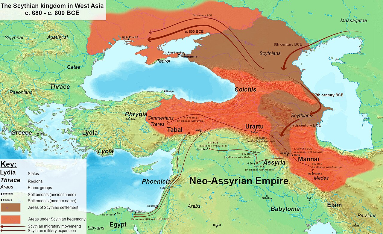
ScythiansRun the image installer to download
ScythiansThe Scythians, steppe horsemen of antiquity. Fomenko and others fold them into a single eternal 'Horde' empire.
The travellers who named it
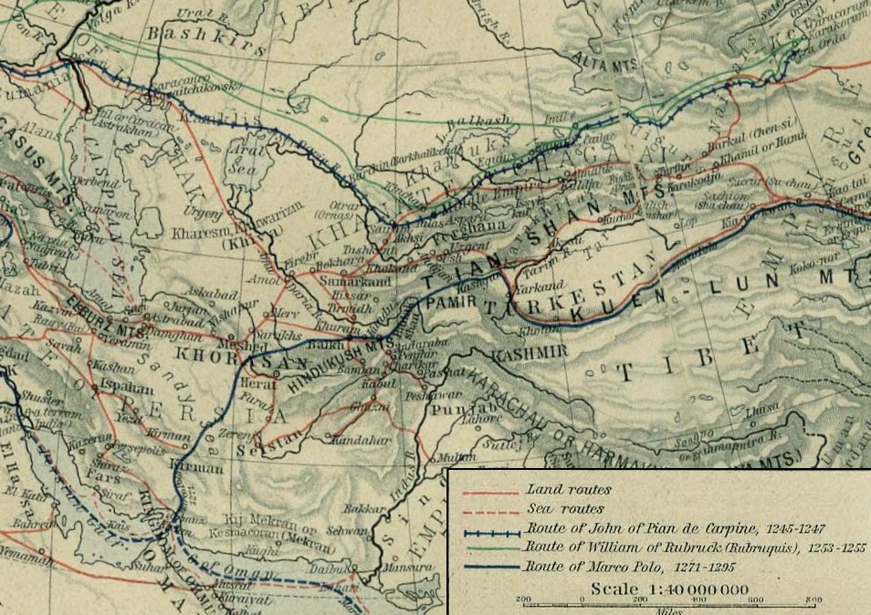
Giovanni da Pian del CarpineRun the image installer to download
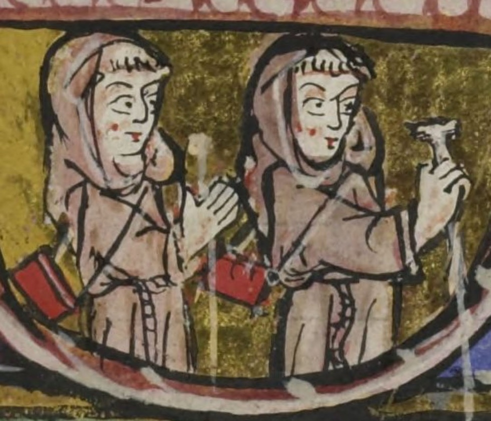
Giovanni da Pian del CarpinePapal envoy Giovanni da Pian del Carpine reached the Great Khan in 1246; his Ystoria Mongalorum, 'History of the Mongols whom we call Tartars', named the threat.
William of RubruckRun the image installer to download
William of RubruckFranciscan friar William of Rubruck travelled to the Mongol capital Karakorum in 1253-55 and saw the Derbent wall linked to Alexander's Gates.
Marco PoloRun the image installer to download
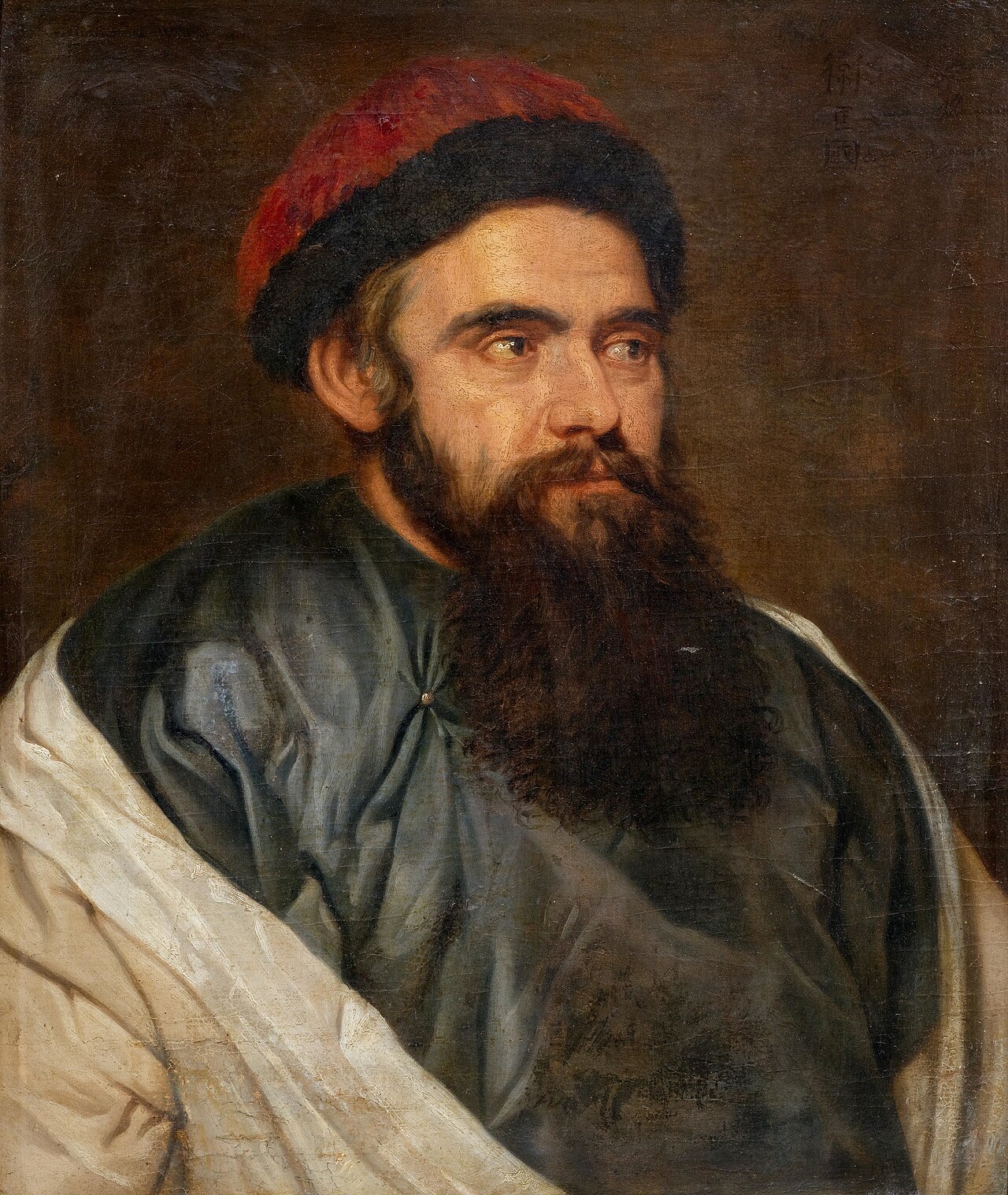
Marco PoloMarco Polo (1254-1324), whose account of Kublai Khan's court was Europe's main window on the 'Grand Tartar' for two centuries.
Martino Martini, De Bello Tartarico (1654)Run the image installer to download
Martino Martini, De Bello Tartarico (1654)Jesuit Martino Martini, whose De Bello Tartarico described the Manchu ('Tartar') conquest of Ming China and spread the label further.
How Tartary grew, split and vanished
The maps
The maps are the heart of both the history and the legend. Read in order, they tell a clear story: a classical blank (Scythia), a medieval world of wonders, one gigantic Tartaria inherited from the memory of the Mongol Empire, a crowd of smaller Tartaries as information improved, and finally modern borders. The empire theory reads the same maps out of order - as proof of a single state that was later hidden.
Antiquity. Ptolemy: Scythia, Sogdiana, Serica. No Tartary.
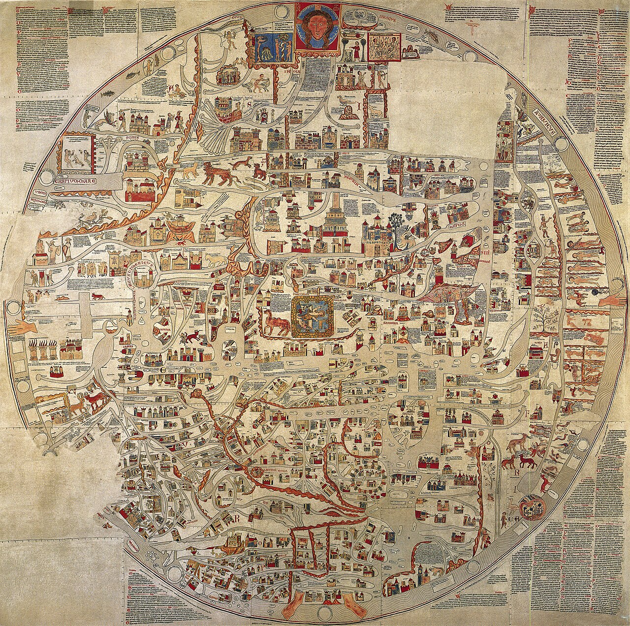
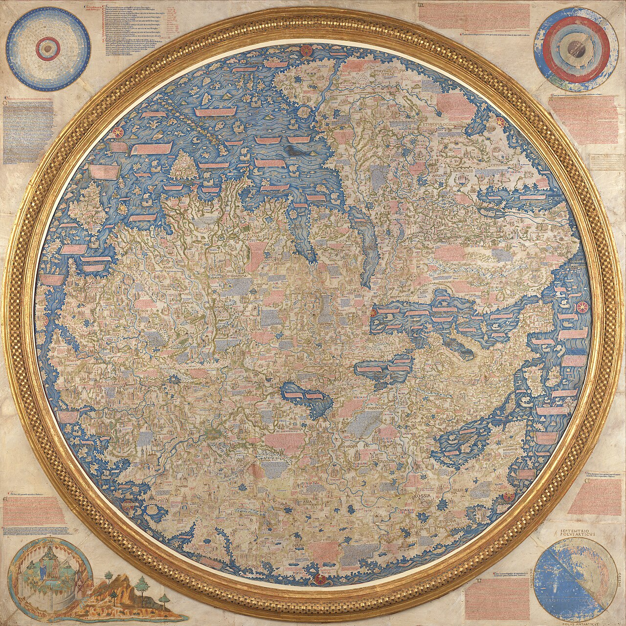
Medieval mappae mundi. Hereford, Ebstorf, Catalan Atlas, Fra Mauro: khans, caravans and walled-in Gog and Magog.
1570: one Tartaria. Ortelius draws a single region from the Volga to the Pacific - about 200 years after the Mongol Empire broke up.
1650s: no borders. Visscher's Tartaria has no internal boundaries or colours - a geographic zone, not a state.
1700s: many Tartaries. De L'Isle shows Independent, Chinese, Western, Eastern, Muscovite and Little Tartary. Strahlenberg (1730) pushes "Great Tartary" south.
1880s: gone. Colton's Central Asia shows Turkestan, Mongolia, Manchuria and the Russian and Chinese empires.
Ptolemaic map of Asia: Scythia and SericaRun the image installer to download
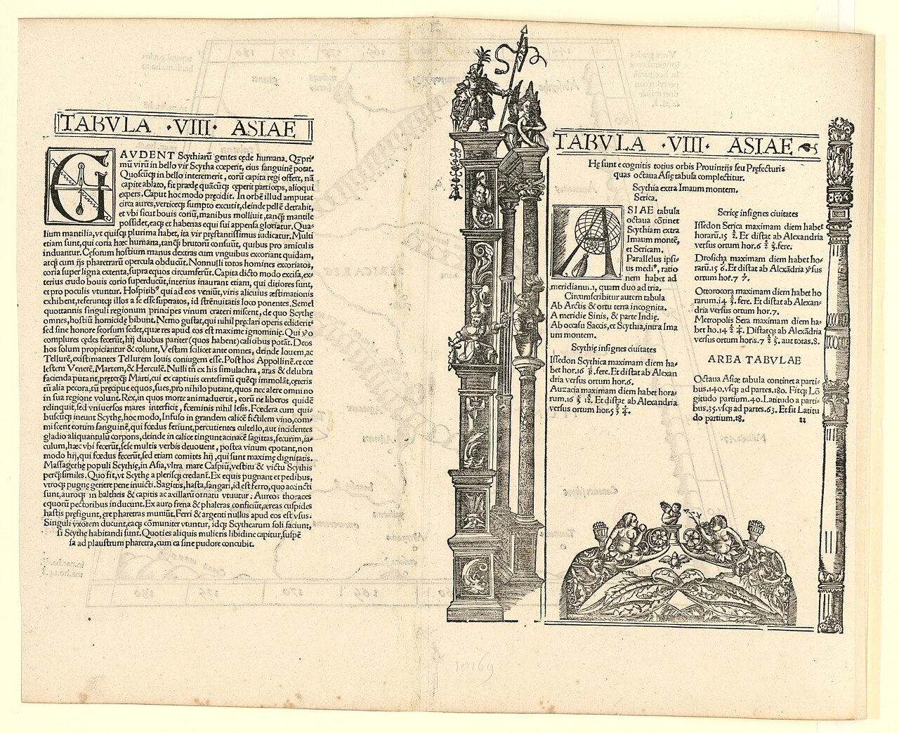
Ptolemaic map of Asia: Scythia and SericaA Renaissance edition of Ptolemy's 2nd-century geography. Before 'Tartary', the same lands were called Scythia, Sogdiana and Serica.
Hereford Mappa Mundi (c. 1300)Run the image installer to download
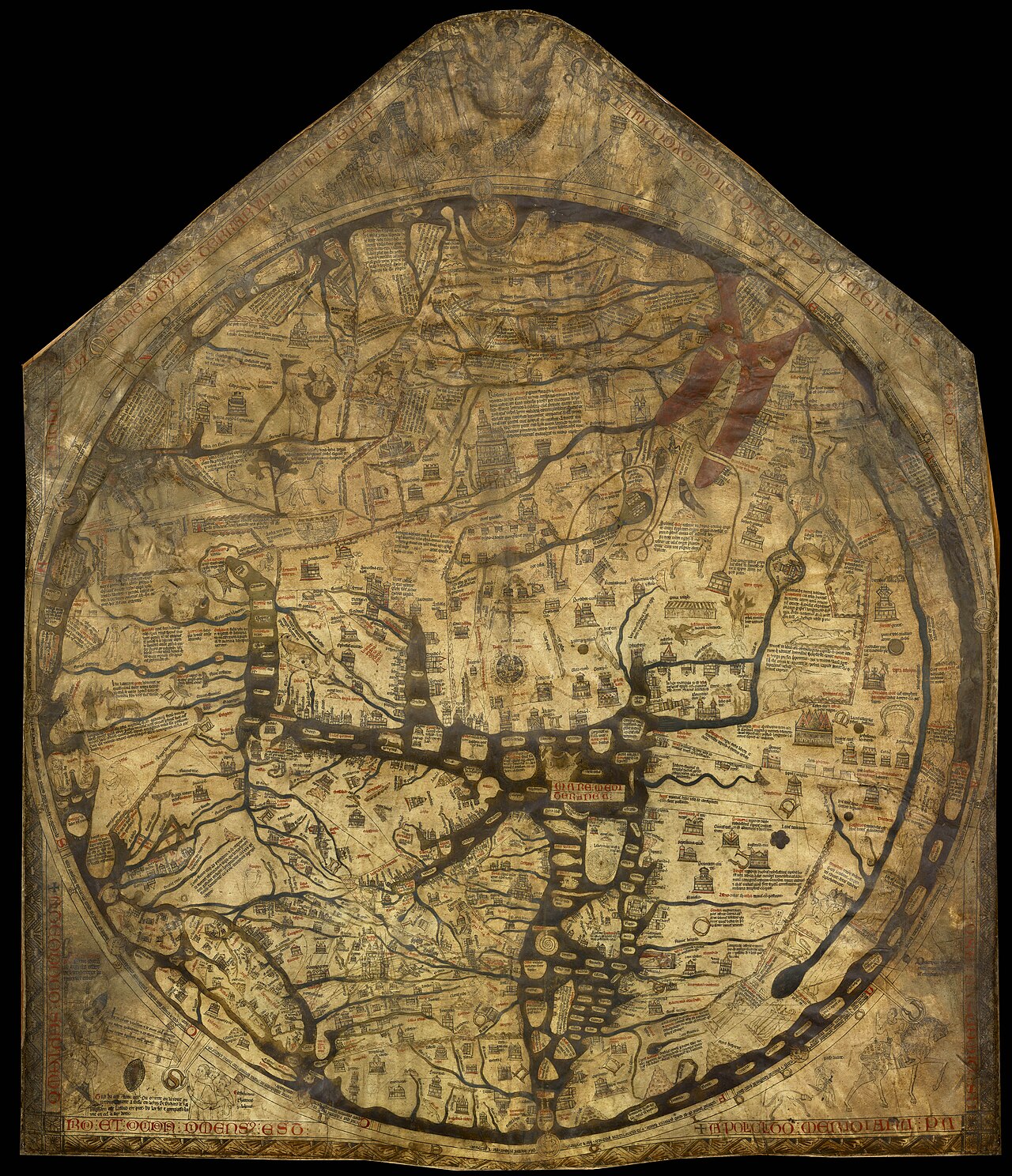
Hereford Mappa Mundi (c. 1300)The Hereford Mappa Mundi, a medieval world map with Jerusalem at the centre and monstrous races at the edges, including enclosed nations in the far north-east.
Ebstorf Map (13th century)Run the image installer to download
Ebstorf Map (13th century)The Ebstorf Map, a giant medieval mappa mundi (destroyed in 1943, known from copies) that places Gog and Magog behind walls in the far north-east of Asia.
Catalan Atlas (1375)Run the image installer to download
Catalan Atlas (1375)The Catalan Atlas of 1375, attributed to Abraham Cresques of Majorca, shows the Mongol khans, caravans on the Silk Road and the lands of Gog and Magog.
Fra Mauro map (c. 1450)Run the image installer to download
Fra Mauro map (c. 1450)Fra Mauro's Venetian world map of about 1450, drawing on Marco Polo and showing the Tartar lands of Asia in detail.
Ortelius, Tartariae sive Magni Chami Regni (1570)Run the image installer to download
Ortelius, Tartariae sive Magni Chami Regni (1570)Abraham Ortelius's 1570 map from the Theatrum Orbis Terrarum, the first atlas map dedicated to Tartary. It shows one vast region from the Volga to the Pacific, still echoing the Mongol Empire of two centuries earlier.
Visscher, map of Asia (c. 1657)Run the image installer to download
Visscher, map of Asia (c. 1657)Nicolaes Visscher's map of Asia, where Tartaria sprawls across the north with no internal borders - a geographic label rather than a political state.
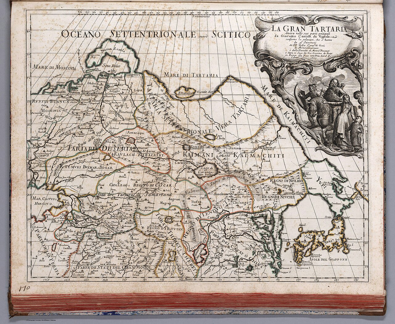
Cantelli da Vignola, La Gran Tartaria (1683-93)Run the image installer to download
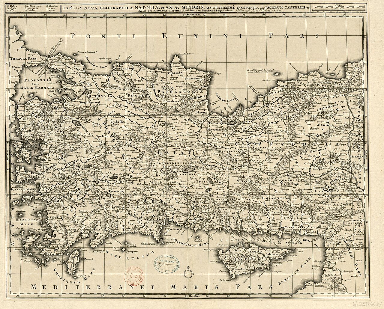
Cantelli da Vignola, La Gran Tartaria (1683-93)Giacomo Cantelli da Vignola's Italian map of Great Tartary, often reposted online as proof of a lost empire.
Strahlenberg, Nova Descriptio Tattariae Magnae (1730)Run the image installer to download
Strahlenberg, Nova Descriptio Tattariae Magnae (1730)Philipp Johann von Strahlenberg, a Swedish officer captured at Poltava and held in Siberia, mapped Great Tartary from first-hand travel; his 1730 map shrinks the name toward Central Asia.
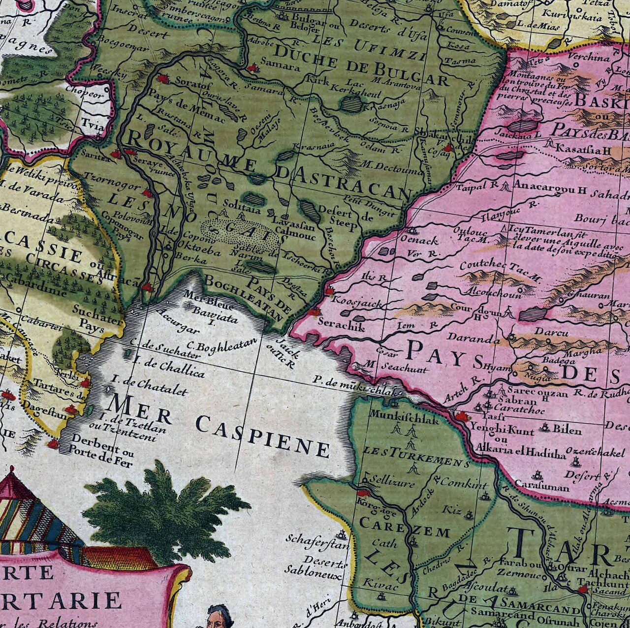
Guillaume de L'Isle, Carte de TartarieRun the image installer to download
Guillaume de L'Isle, Carte de TartarieGuillaume de L'Isle's Carte de Tartarie, which splits the region into many Tartaries - Independent, Chinese, Muscovite, Little - as European information improved.
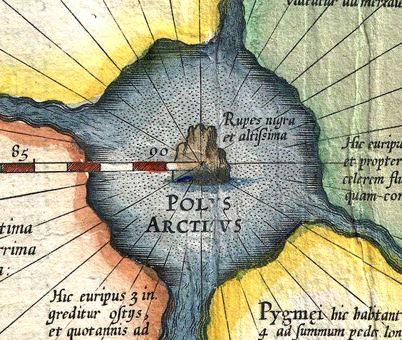
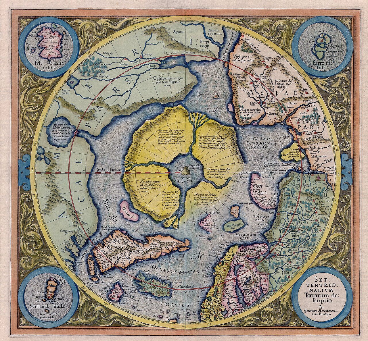
Mercator, Septentrionalium Terrarum (1595)Run the image installer to download
Mercator, Septentrionalium Terrarum (1595)Gerardus Mercator's 1595 map of the North Pole: four islands around a whirlpool and a black magnetic rock, Rupes Nigra. Popular in Hyperborea and Tartaria circles; based on the lost Inventio Fortunata.
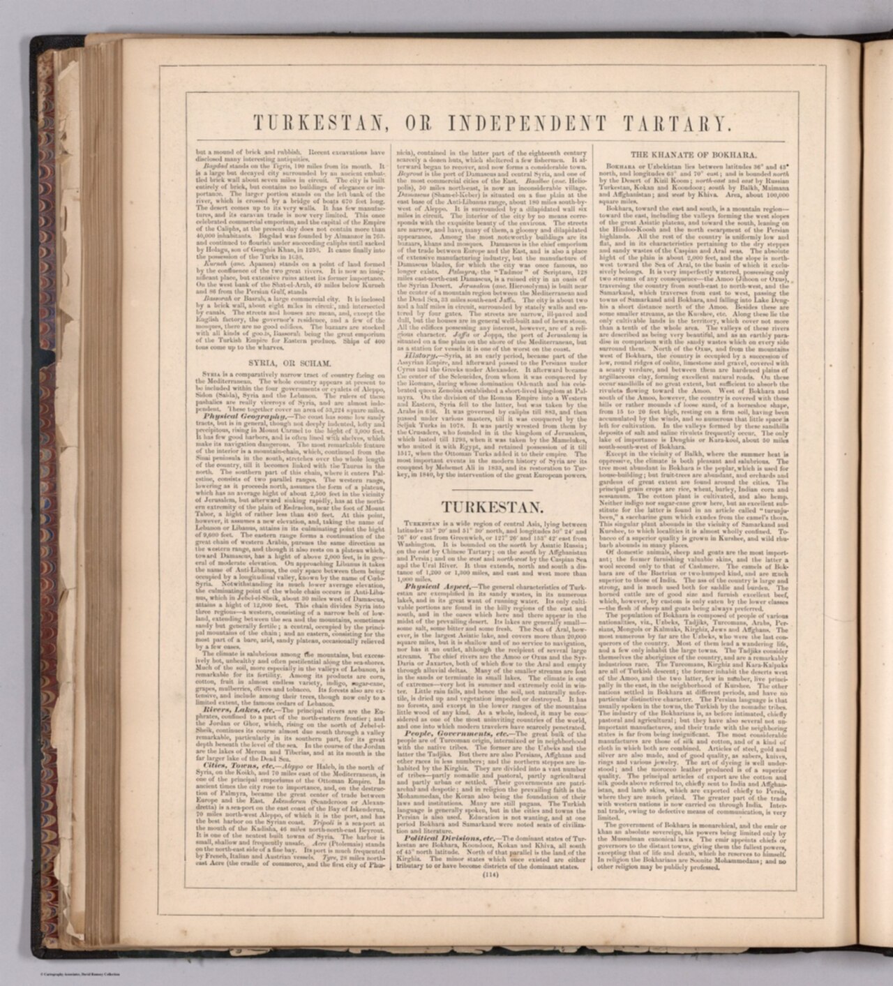
Colton, Central Asia (1880s)Run the image installer to download
Colton, Central Asia (1880s)By the 1880s American and European maps had replaced Tartary with Turkestan, Mongolia, Manchuria and the Russian and Chinese empires.
The 1771 Britannica entry
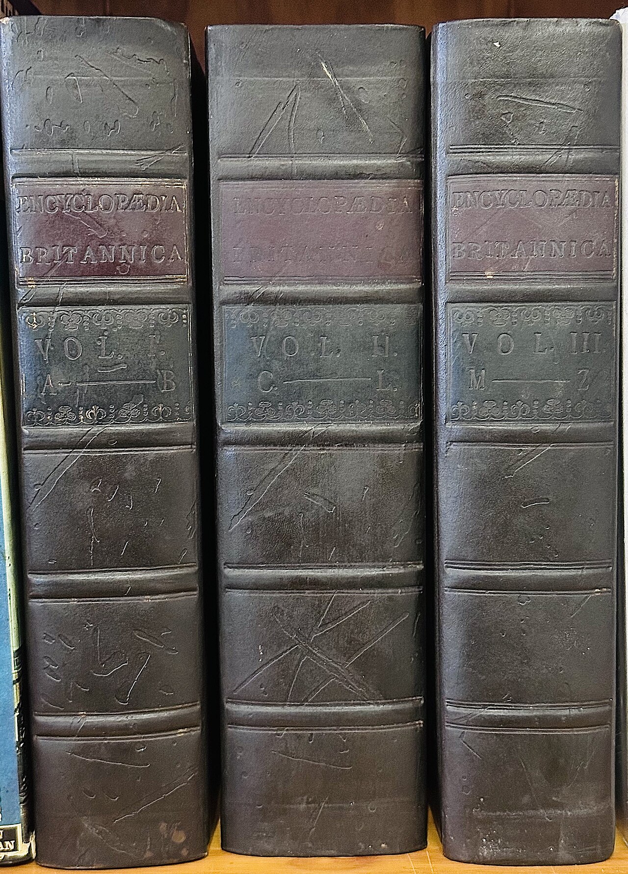
The most-shared "proof" online is the first Encyclopaedia Britannica, which calls Tartary a vast country in the north of Asia. Read in full, the entry goes on to list several different Tartar peoples and places - Astrakhan, Circassia and Dagestan, the Kalmyks, the Uzbeks and Moguls, and Tibet. It describes a region with many peoples, not one government. It gives no area figure; the often-repeated claim that it called Tartary the largest country in the world is not in the text.
Encyclopaedia Britannica, 1st edition (1768-71)Run the image installer to download
Encyclopaedia Britannica, 1st edition (1768-71)Title page of the first Encyclopaedia Britannica. Its 1771 entry calls Tartary a vast country in northern Asia - a line widely shared online as proof of an empire.
The owl and the dragon
Flags & symbols
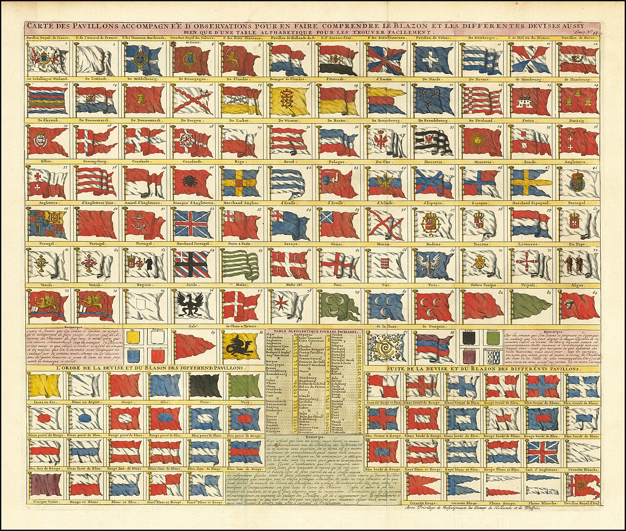
Online, the Tartarian Empire has a flag: a yellow field with a black owl, or a yellow swallowtail with a black winged dragon. Both come from Dutch flag books by Carel Allard (1694, 1705) and copycat charts that filled the 1700s. These charts mixed real naval ensigns with guesses for remote rulers - the Great Mogul, Prester John, the "Tartarian Emperor". Flag historians regard the Tartary flags as engraver's fantasies; no khanate is known to have used them. Real steppe banners were often poles topped with horse-tail standards, and real steppe symbols were clan tamgas.
'Tartarian' owl flag (Allard flag books)Run the image installer to download
'Tartarian' owl flag (Allard flag books)Yellow flag with a black owl, printed in Carel Allard's Dutch flag books (1694/1705) as a flag of the Tartars. Vexillologists consider it a mapmaker's invention; believers treat it as the empire's flag.
'Flag of the Tartarian King' (dragon)Run the image installer to download
'Flag of the Tartarian King' (dragon)Yellow swallow-tailed flag with a black winged dragon, captioned as the Tartarian emperor's flag in Allard's flag charts. No historical khanate is known to have flown it.
18th-century chart of world flagsRun the image installer to download
18th-century chart of world flagsEarly 18th-century flag charts like Chatelain's mixed real naval ensigns with imagined ones for distant powers such as Tartary, the Mogul and Prester John.
Zilant, the dragon of KazanRun the image installer to download
Zilant, the dragon of KazanZilant, the winged serpent on Kazan's coat of arms. Sometimes linked to the 'Tartarian dragon flag', though heraldists say its origin is different.
Tamga - steppe clan sealsRun the image installer to download
Tamga - steppe clan sealsTamgas, the clan and ownership marks of Turkic and Mongol peoples - the real symbol system of the steppe.
From Moscow to YouTube
The lost-empire theory
The modern legend has two roots. One is Russian pseudo-history: Anatoly Fomenko's New Chronology squeezed world history into the last thousand years and described a Russian-Turkic "Horde", Great Tartary, hidden by Western and Romanov falsifiers. Nikolai Levashov's occult books turned it into a Slavic-Aryan super-empire. The other root is English-language internet culture after 2016, which dropped most of the Russian nationalism and focused on photographs: grand old buildings, empty streets, world's fairs and star forts.
Researchers note it has no single storyline. Builders, dates and villains change from post to post. It works more like a mood - grief for lost craftsmanship, distrust of official history - than like a theory. Bloomberg's CityLab called it "the QAnon of architecture"; a 2024 study in the journal Religion tied it to meme culture and image-sharing platforms.
Jesuit Jean Hardouin argues nearly all classical texts were forged by medieval monks.
Revolutionary-scientist Nikolai Morozov publishes a radical re-dating of ancient history.
Mathematician Anatoly Fomenko develops the 'New Chronology'; with Gleb Nosovsky he later describes a Slav-Turk 'Horde' empire, Great Tartary, hidden by Romanov and Vatican falsifiers.
Fomenko's books sell over a million copies in Russia; Ynglism and other neo-pagan groups spread a 'Slavic-Aryan' ancient empire.
Nikolai Levashov's books describe Rassenia / Great Tartaria, falling only with Pugachev's rebellion. One is later banned in Russia as extremist (2010).
The English-language 'Tartarian Empire' and 'mud flood' ideas start circulating on YouTube and forums.
StolenHistory.org posts, including a misread 1957 CIA file, become the shared source pool.
The Notre-Dame fire is read in Tartaria groups as deliberate erasure; r/Tartaria grows quickly.
The Russian Geographical Society publicly rejects the theory and points people to its own Tartary maps.
Skeptoid episode 765; Bloomberg CityLab calls it 'the QAnon of architecture'.
TikTok and Instagram reels spread world's-fair photos with 'Tartarian' captions; academic studies of the movement appear (e.g. Maurer in Religion, 2024).
Recurring ingredients
mud flood
star forts
world's fairs
free / aetheric energy
giants
orphan trains
incubator babies
empty streets
reset
CIA document
old maps
owl flag
mother trees
New Chronology
phantom time
Claim vs. record
The claims, one by one
Ornate buildings were inherited, not built
What believers say
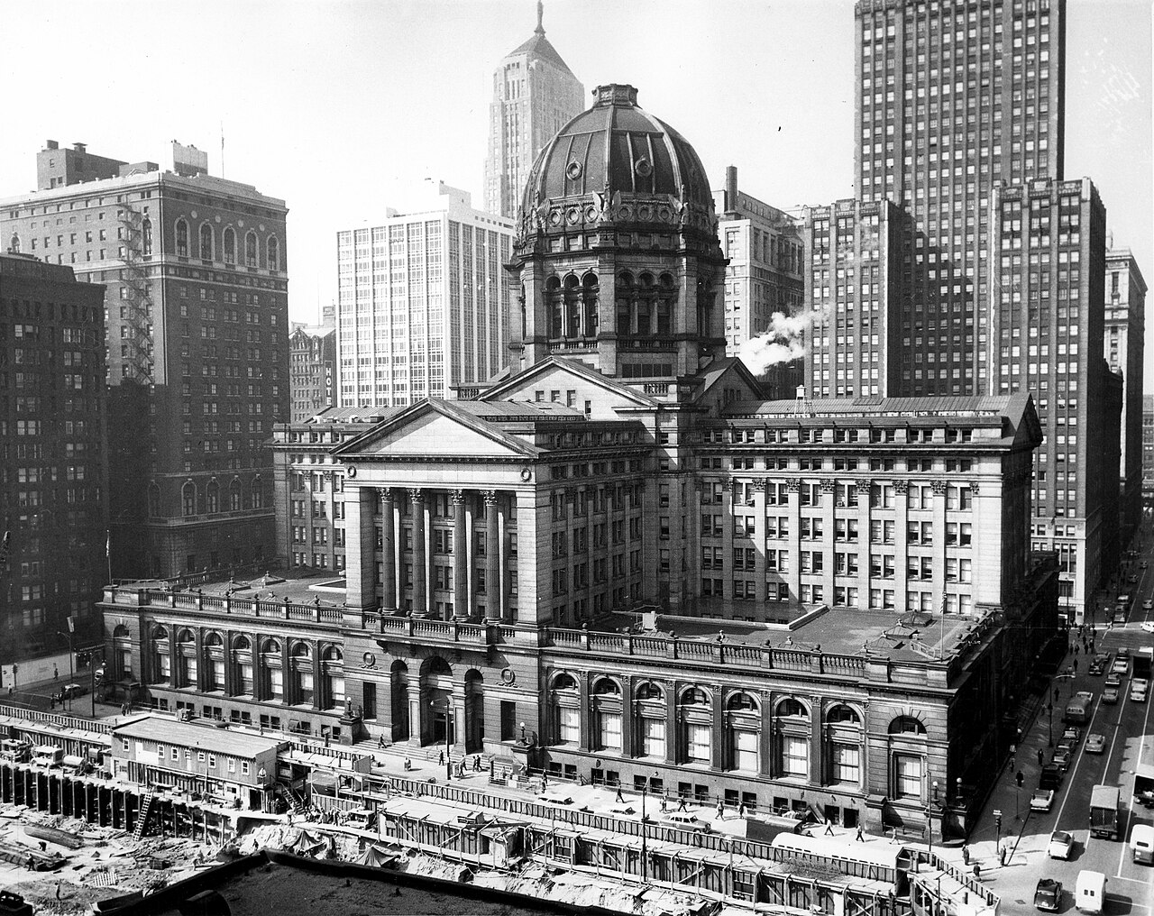
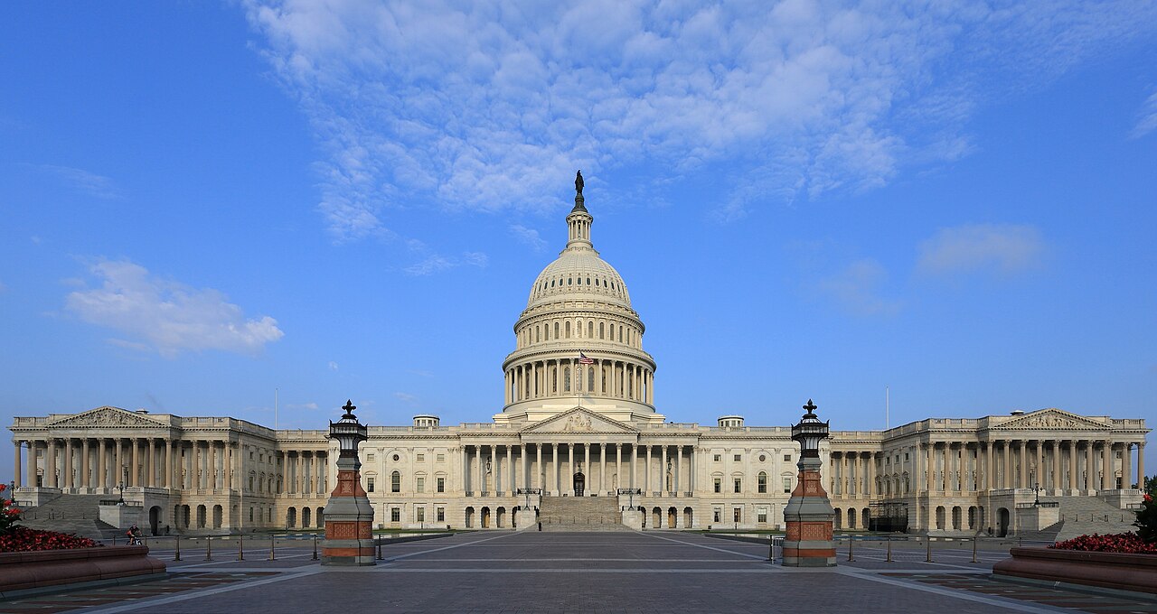
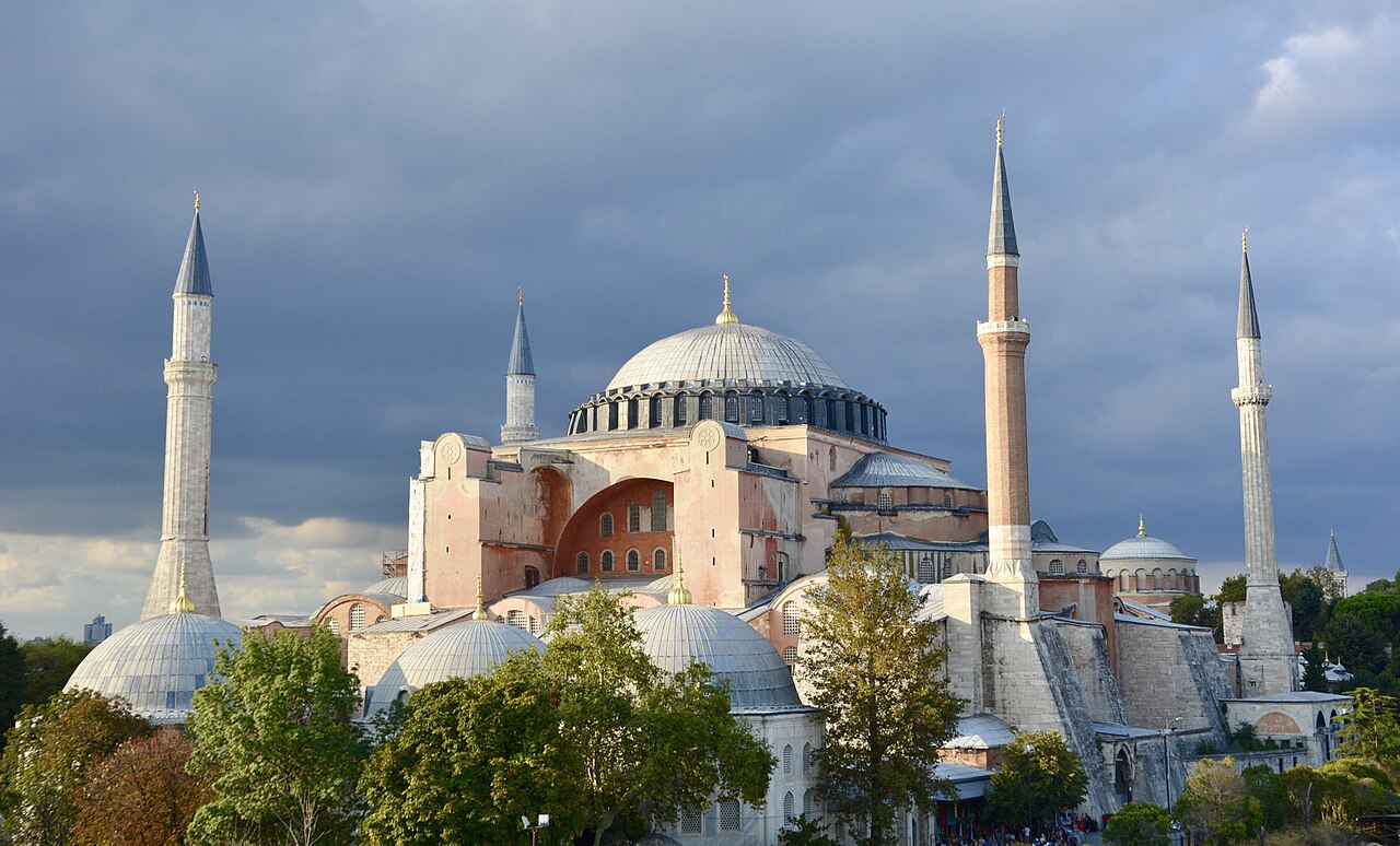
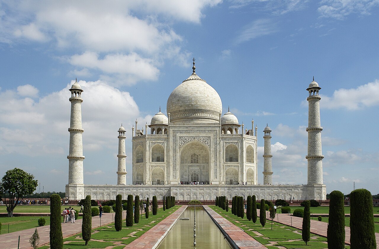
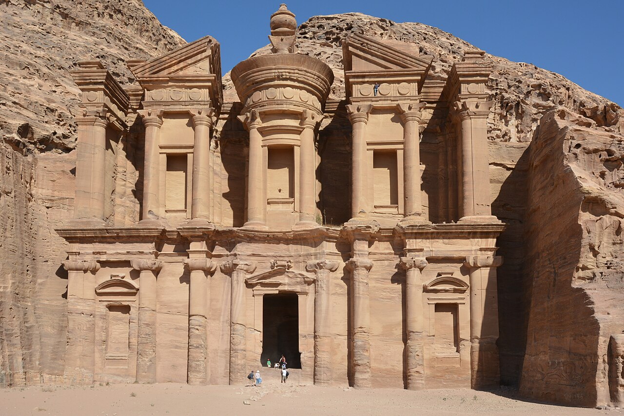
The domes, columns and towers of 19th-century cities were too grand for their 'official' builders. They were Tartarian buildings found already standing, re-labelled with fake construction dates. Short-lived buildings (Penn Station, the Singer Building, the Chicago Federal Building) were destroyed because they were evidence. Lists grow to include the Capitol, Notre-Dame, Hagia Sophia, the Taj Mahal, Petra and the pyramids.
What the record shows
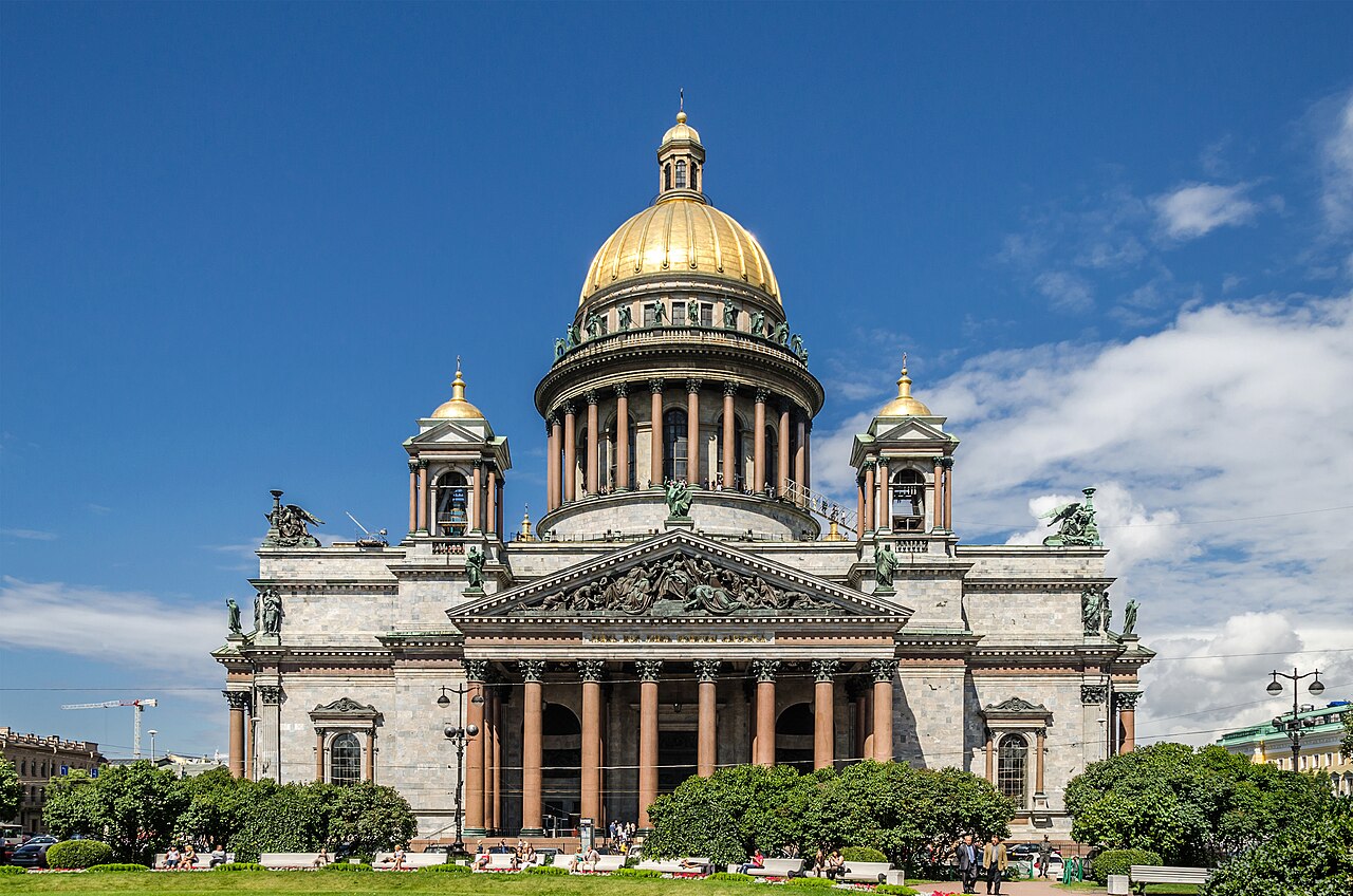
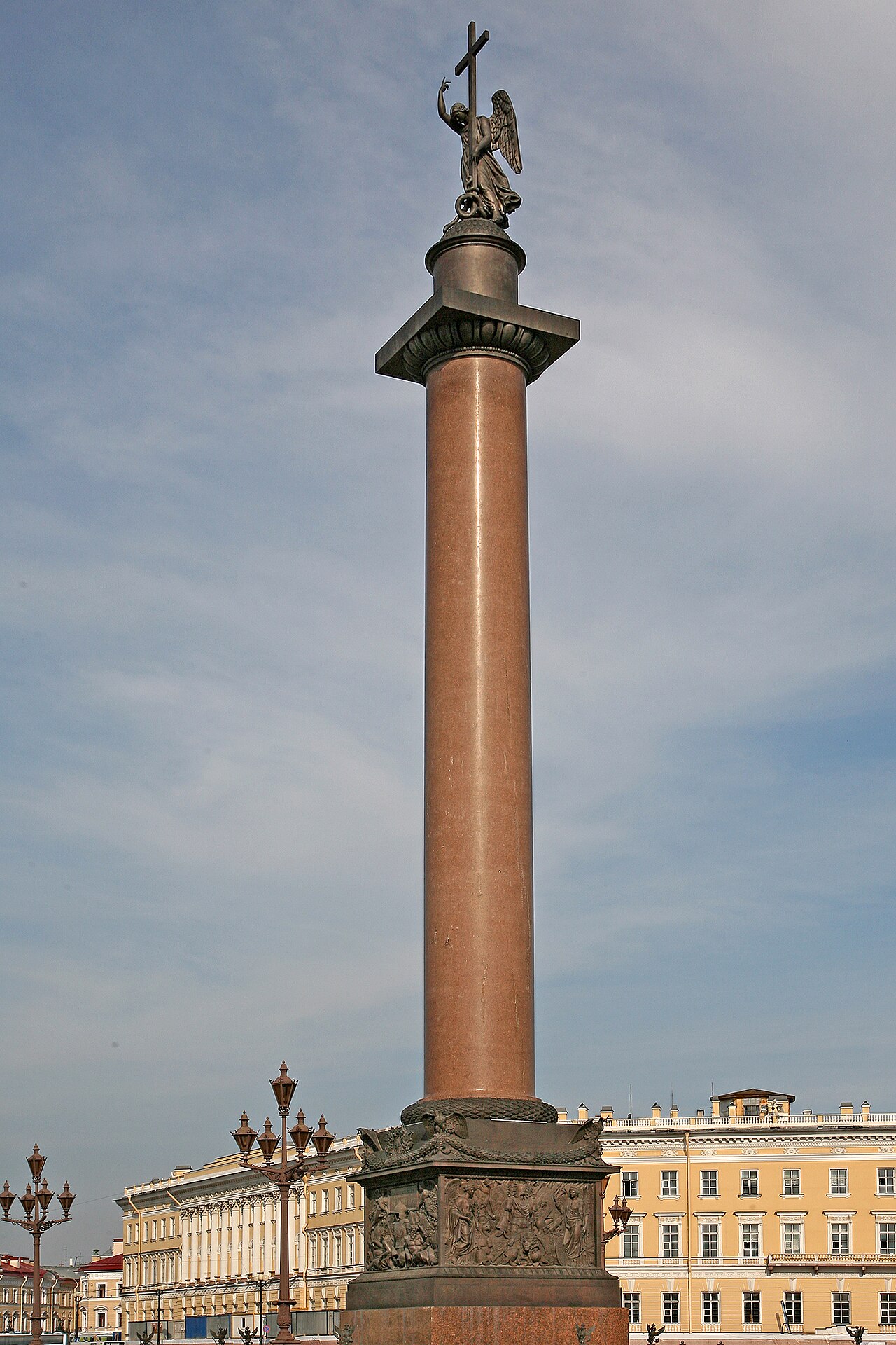
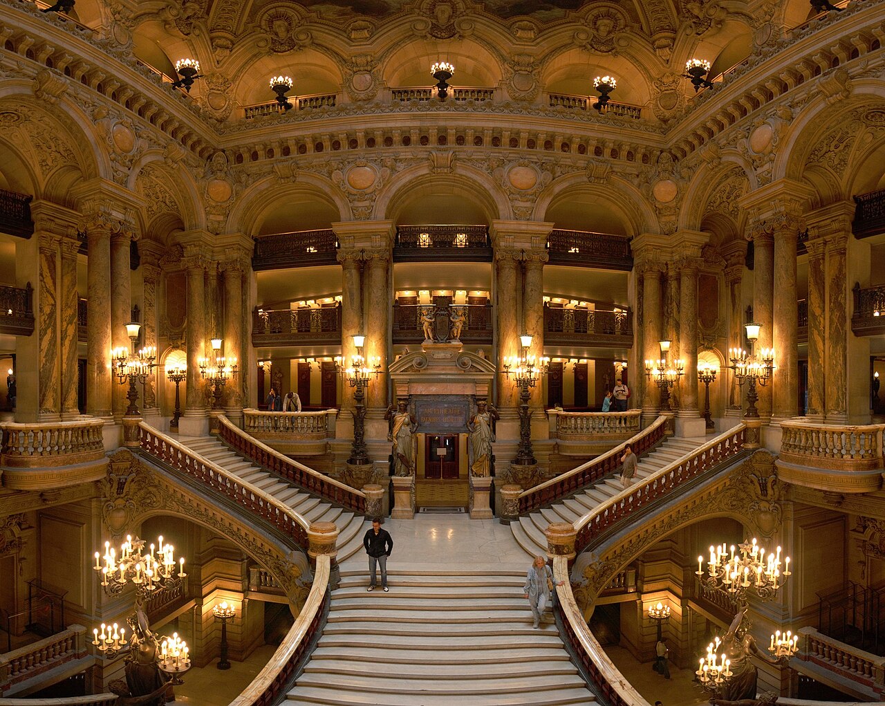
The buildings named have architects, contracts, construction photographs and newspaper coverage. The matching look comes from shared training (the Ecole des Beaux-Arts in Paris trained architects from every continent), pattern books, and empires exporting their styles. Many were demolished for ordinary reasons - land value, maintenance, changing taste - and their loss is what started the modern preservation movement after Penn Station fell in 1963. In St. Petersburg, the raising of St. Isaac's columns and the Alexander Column was documented in engineering drawings and eyewitness accounts at the time.
Check it yourself: Search a building's name with 'construction' in a newspaper archive like Chronicling America (Library of Congress). Most show the building rising over years.
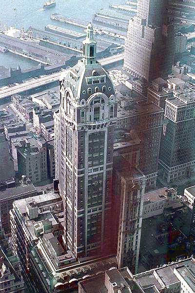
Singer Building, New York (1908-1968)Run the image installer to download
Singer Building, New York (1908-1968)Ernest Flagg's Beaux-Arts Singer Building, once the world's tallest, demolished in 1968. A favourite 'Tartarian building' because it was destroyed.
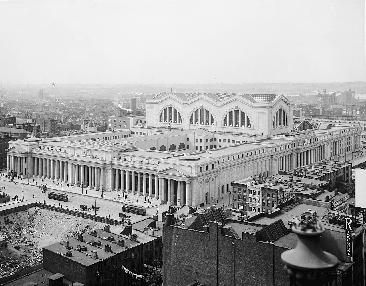
Pennsylvania Station, New York (1910-1963)Run the image installer to download
Pennsylvania Station, New York (1910-1963)McKim, Mead & White's Pennsylvania Station, demolished in 1963 - an act that launched the modern historic-preservation movement and now fuels Tartaria claims.
Chicago Federal Building (1905-1965)Run the image installer to download
Chicago Federal Building (1905-1965)Henry Ives Cobb's domed Chicago Federal Building, demolished in 1965 after about 60 years - cited as a 'too-short-lived' Tartarian building.
United States CapitolRun the image installer to download
United States CapitolThe U.S. Capitol, begun in 1793 with its cast-iron dome completed in 1866 - claimed by some believers to be thousands of years old.
Saint Isaac's Cathedral, St. PetersburgRun the image installer to download
Saint Isaac's Cathedral, St. PetersburgSt. Isaac's Cathedral (1818-1858). Russian Tartaria writers claim its 114-ton granite columns were beyond 19th-century builders - yet the quarrying and raising was documented in drawings.
Alexander Column, St. PetersburgRun the image installer to download
Alexander Column, St. PetersburgThe 600-ton Alexander Column, erected in 1832 by Auguste de Montferrand with 2,000 soldiers and capstans in under two hours - a documented feat often claimed as 'impossible'.
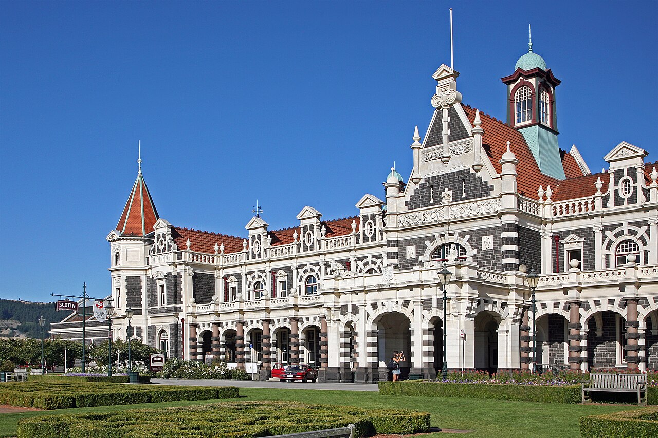
Dunedin Railway Station, New ZealandRun the image installer to download
Dunedin Railway Station, New ZealandGeorge Troup's 1906 Dunedin Railway Station, said by New Zealand Tartaria believers to predate European settlement.
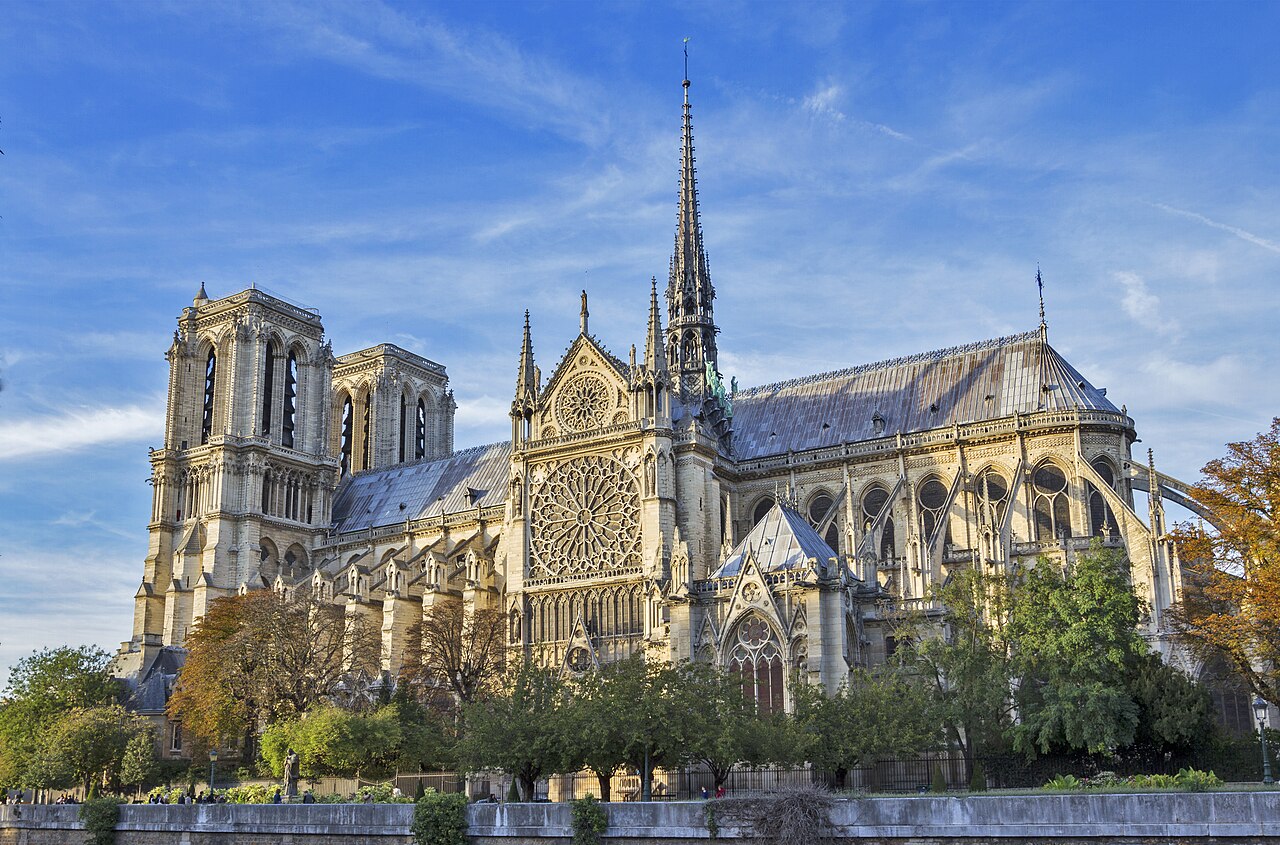
Notre-Dame de ParisRun the image installer to download
Notre-Dame de ParisNotre-Dame de Paris, begun in 1163. The 2019 fire was read in Tartaria groups as another erasure of Tartarian architecture.
A 'mud flood' buried the old world
What believers say
Sometime in the 1700s-1800s a global flood of mud buried the ground floors of Tartarian cities. Below-grade windows, doors opening onto pits, and basements with fine finishes are the 'buried first storeys'. Photos of unpaved streets show the clean-up.
What the record shows
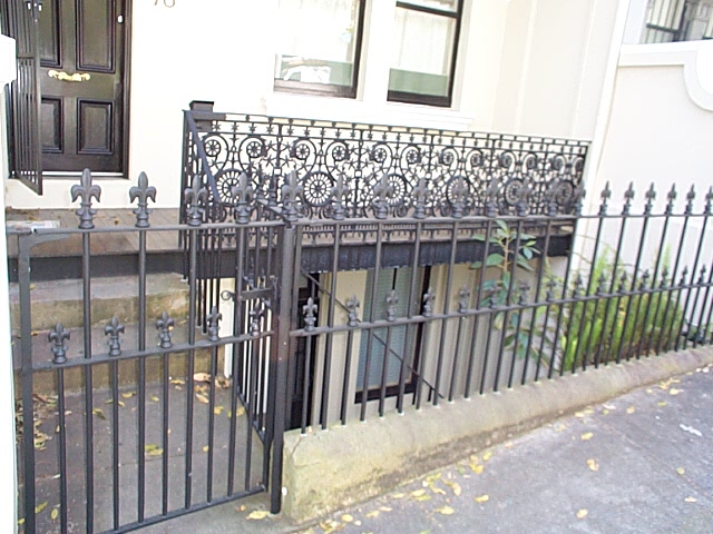
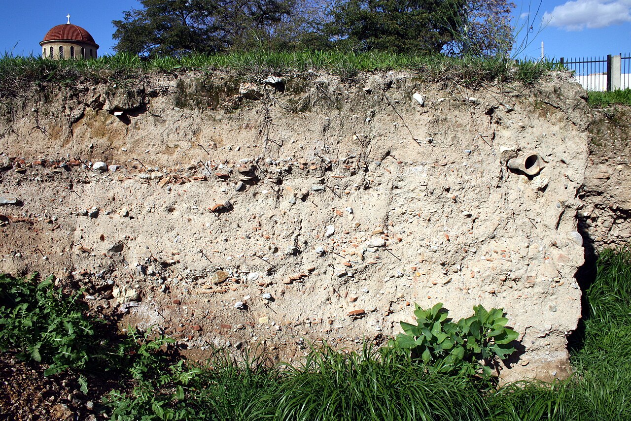
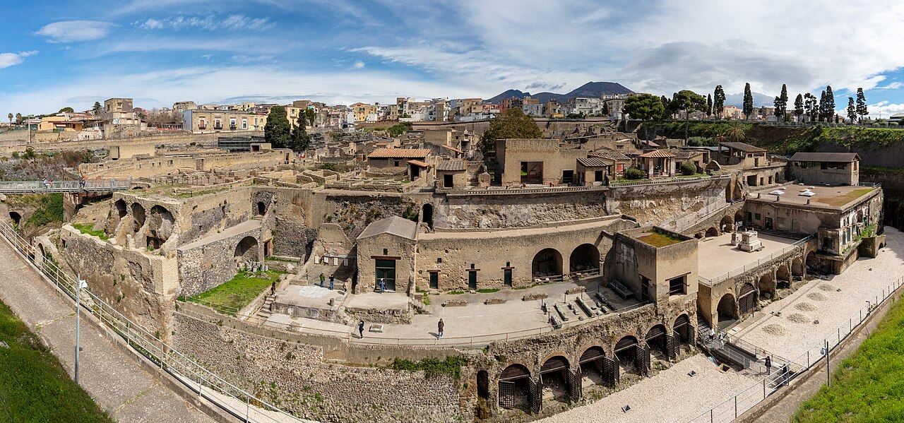
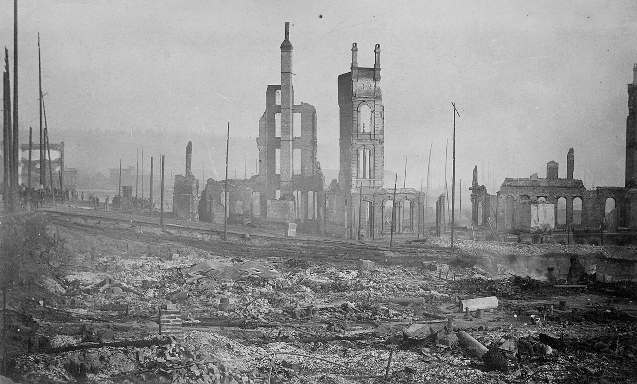
Cities rise on their own debris - a slow build-up archaeologists call the cultural layer. Some cities raised their streets on purpose: Chicago jacked up whole blocks 4 to 6 feet with thousands of jackscrews from 1858 to install sewers, and Seattle regraded streets one to two storeys after its 1889 fire, leaving the Seattle Underground. Before electric light, areaways and half-sunk basement windows were standard design for servants' rooms, coal and storage. A real sudden burial looks like Herculaneum: a single dated layer, bodies and objects in place. No such layer exists across the world's cities.
Check it yourself: If you see a 'buried' window, check the building's original drawings or Sanborn fire-insurance maps, which record basement levels.
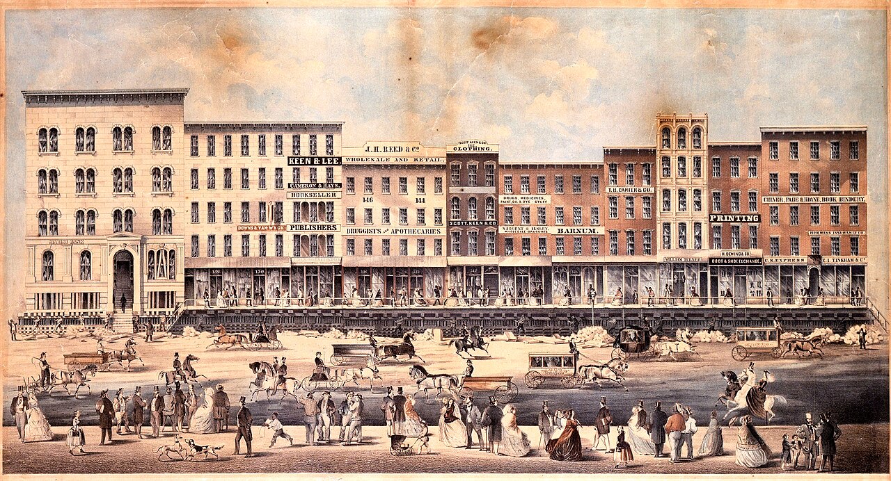
Raising of Chicago (1850s-60s)Run the image installer to download
Raising of Chicago (1850s-60s)Chicago jacked up whole blocks by 4 to 6 feet with thousands of jackscrews in the 1850s-60s to install sewers - why old ground floors there sit 'buried'.
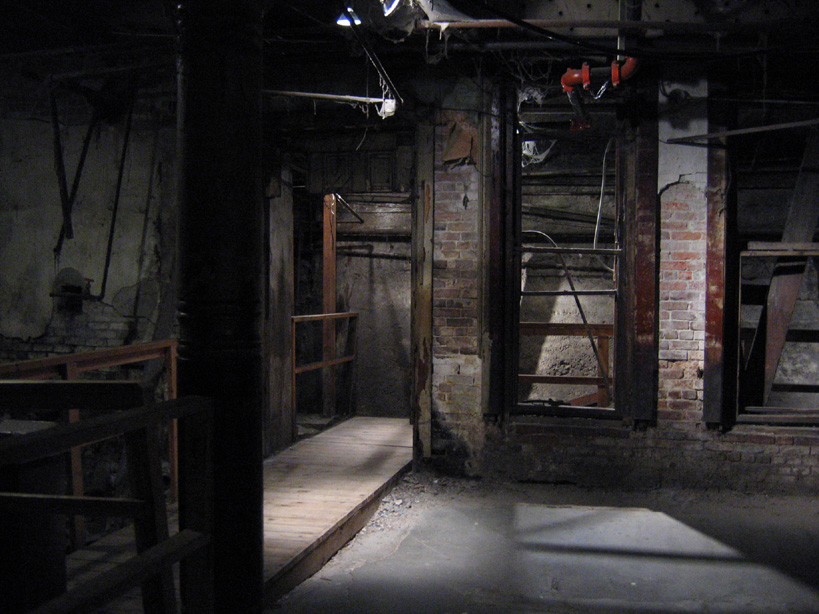
Seattle UndergroundRun the image installer to download
Seattle UndergroundAfter the 1889 Great Seattle Fire, streets were raised one to two storeys, leaving old storefronts and sidewalks underground - a documented 'mud flood'.
Areaways and basement windowsRun the image installer to download
Areaways and basement windowsAn areaway: a sunken courtyard that brings light to basement rooms. Before electric light, below-grade windows were deliberate design, not buried ground floors.
Archaeological stratigraphyRun the image installer to download
Archaeological stratigraphyStratigraphy: cities rise slowly on their own debris (the 'cultural layer'), roughly 1 m per few centuries - the everyday reason old doors end up below street level.
Herculaneum - a real buried cityRun the image installer to download
Herculaneum - a real buried cityHerculaneum, buried up to 20 m deep by the 79 AD eruption of Vesuvius - what a genuine sudden burial looks like archaeologically.
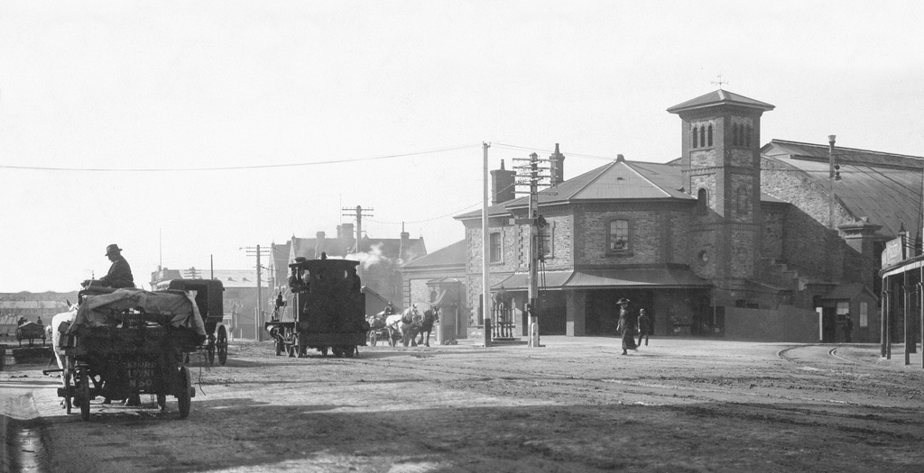
Muddy horse-drawn streetsRun the image installer to download
Muddy horse-drawn streets19th-century city streets were unpaved mud and manure - the ordinary reality behind 'mud flood' photographs.
Star forts were Tartarian power stations
What believers say
Star-shaped forts appear from Europe to Japan to the Americas, so one global civilisation must have built them. Their shape is said to channel energy, resonate sound or harvest aether; moats were coolant or conductors.
What the record shows
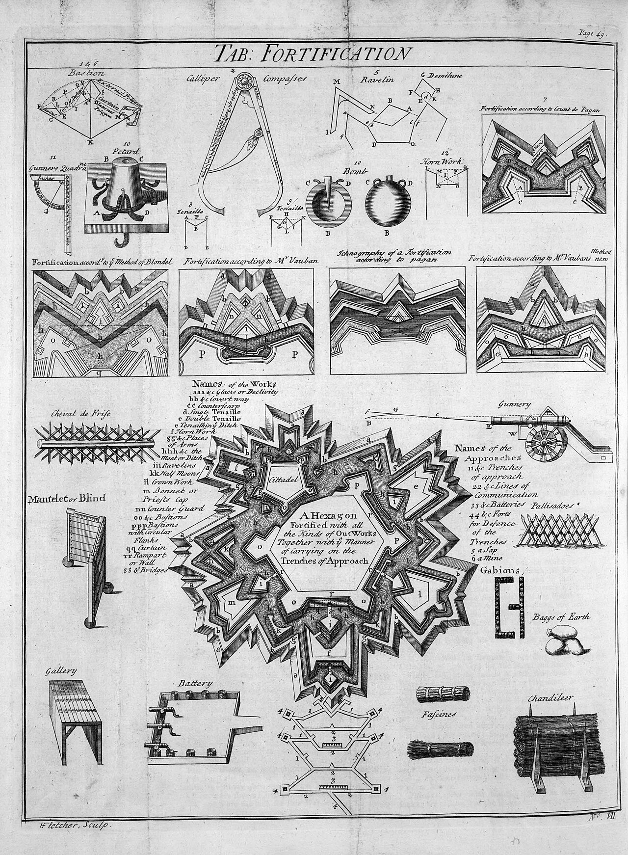
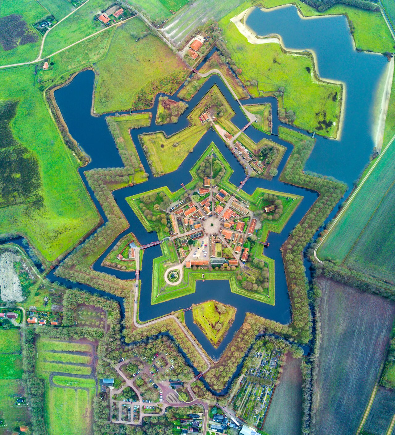
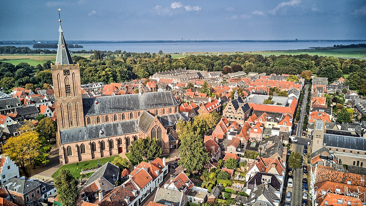
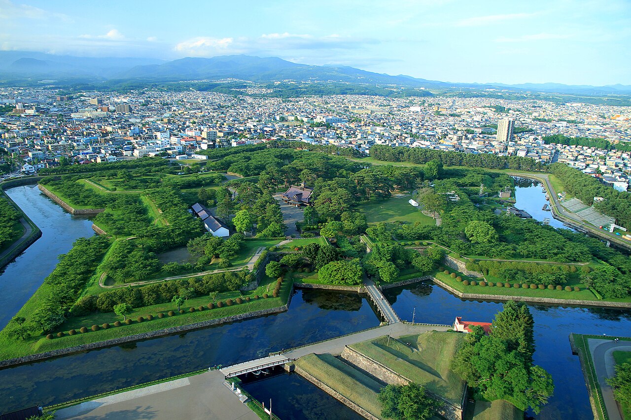
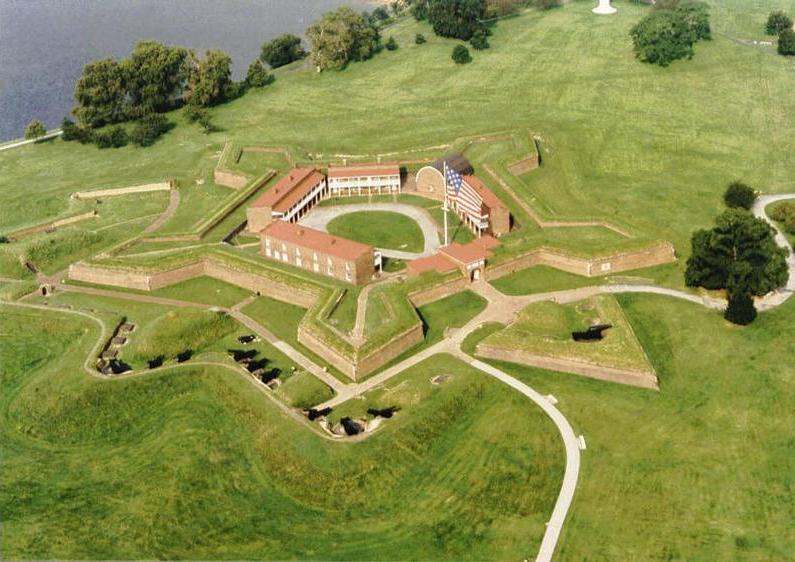
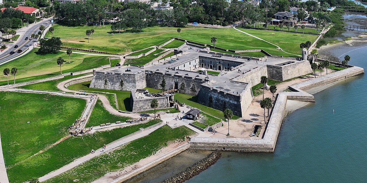
The bastion fort (trace italienne) was invented in Italy around 1500 to survive cannon fire. Angled bastions remove blind spots so defenders can fire along every wall. It spread through printed engineering manuals; designers like Michelangelo, Coehoorn and Vauban are documented. The style reached Japan via French textbooks: Goryokaku was finished in 1866. Construction accounts survive for most - Bourtange (1593), Palmanova (1593), Castillo de San Marcos (1672-95), Fort McHenry (1798-1800).
Check it yourself: Every star fort on this page has a dated founding and named engineer in its national heritage register.
The bastion fort (trace italienne)Run the image installer to download
The bastion fort (trace italienne)The bastion or 'star' fort, an Italian answer to cannon around 1500: angled bastions remove blind spots and let defenders sweep every wall.
Fort Bourtange, NetherlandsRun the image installer to download
Fort Bourtange, NetherlandsBourtange, a five-pointed fortified village in Groningen built in 1593 during the Eighty Years' War and restored in the 1960s.
Palmanova, ItalyRun the image installer to download
Palmanova, ItalyPalmanova, a nine-pointed ideal fortress city founded by Venice in 1593 - a UNESCO site and a Tartaria favourite from aerial photos.
Naarden, NetherlandsRun the image installer to download
Naarden, NetherlandsNaarden, a Dutch double-moated star fortress town; its bastions were built from 1675.
Goryōkaku, Hakodate, JapanRun the image installer to download
Goryōkaku, Hakodate, JapanGoryokaku in Hakodate, Japan, a star fort designed by Takeda Ayasaburo from French manuals and finished in 1866 - proof the design was copied from books.
Fort McHenry, BaltimoreRun the image installer to download
Fort McHenry, BaltimoreFort McHenry (1798-1800), the American star fort whose 1814 bombardment inspired The Star-Spangled Banner.
Castillo de San Marcos, FloridaRun the image installer to download
Castillo de San Marcos, FloridaThe Spanish Castillo de San Marcos at St. Augustine (1672-1695), built of coquina shell stone with bastions in the Italian style.
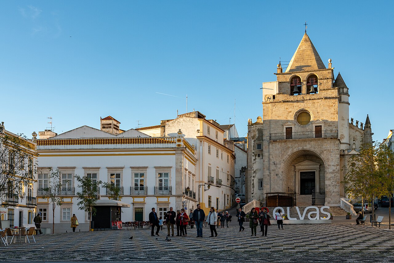
Elvas, PortugalRun the image installer to download
Elvas, PortugalElvas, Portugal, the largest bastioned dry-ditch fortification system in the world and a UNESCO site.
World's fairs were Tartarian capitals
What believers say
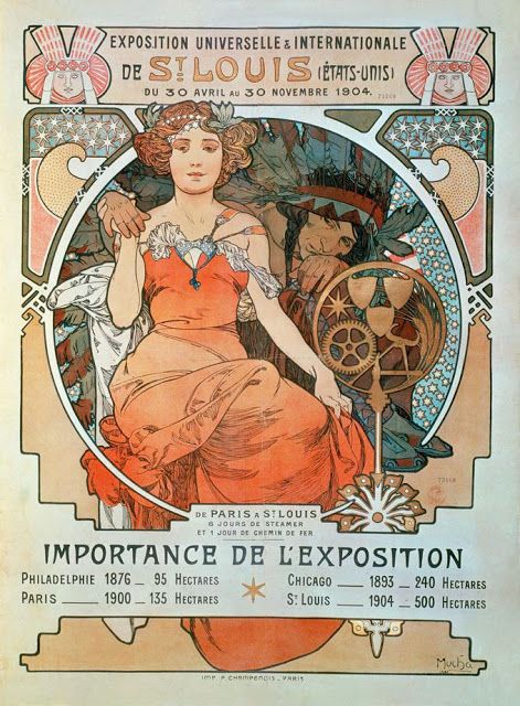
Fairs like Chicago 1893, Buffalo 1901, St. Louis 1904 and San Francisco 1915 were too vast to build in two or three years and were torn down too quickly. They were old Tartarian cities, briefly displayed and then destroyed.
What the record shows
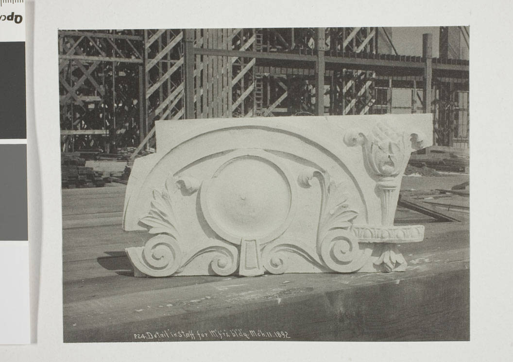
Fair palaces were stage sets: wooden or steel frames clad in staff, a cheap mix of plaster and fibre cast in moulds. Chicago's White City stood under six months and burned in the winter of 1893-94; its one stone-backed building, the Palace of Fine Arts, became the Museum of Science and Industry. San Francisco's Palace of Fine Arts had to be rebuilt in concrete in the 1960s because the original plaster was crumbling. Thousands of construction photos, payroll records and contracts survive.
Check it yourself: The Library of Congress and the Chicago History Museum hold construction-phase photographs of the 1893 fair.
World's Columbian Exposition, Chicago (1893)Run the image installer to download
World's Columbian Exposition, Chicago (1893)Chicago's 1893 'White City': wood frames clad in staff, a plaster-and-fibre mix, built in about two years and mostly burned in 1894.
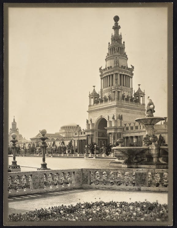
Tower of Jewels, PPIE 1915Run the image installer to download
Tower of Jewels, PPIE 1915The 435-ft Tower of Jewels at San Francisco's 1915 Panama-Pacific Exposition, hung with about 100,000 cut-glass 'Novagems' and torn down after the fair.
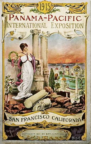
Panama-Pacific International Exposition (1915)Run the image installer to download
Panama-Pacific International Exposition (1915)The Panama-Pacific Exposition, built in under three years on landfill in San Francisco's Marina - claimed by believers to be an ancient Tartarian capital.
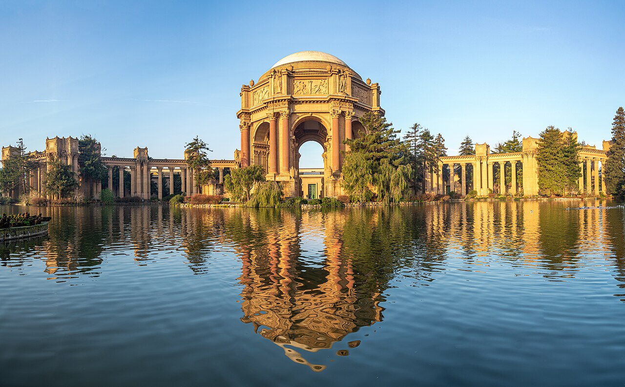
Palace of Fine Arts, San FranciscoRun the image installer to download
Palace of Fine Arts, San FranciscoBernard Maybeck's Palace of Fine Arts, the one 1915 fair building kept; its crumbling plaster was rebuilt in concrete in the 1960s.
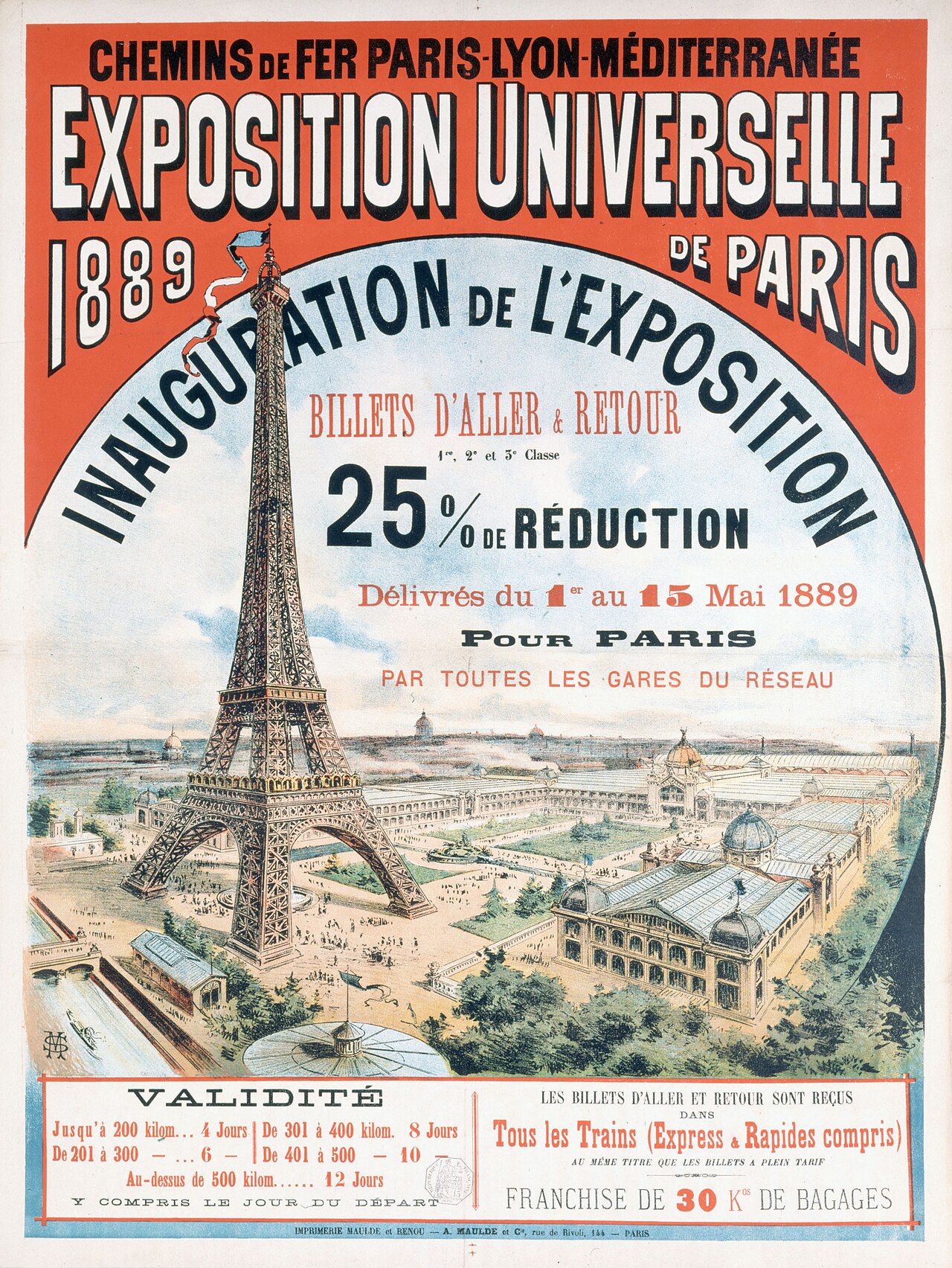
Exposition Universelle, Paris (1889)Run the image installer to download
Exposition Universelle, Paris (1889)The 1889 Paris world's fair, which gave the Eiffel Tower; its Galerie des machines was demolished in 1910.
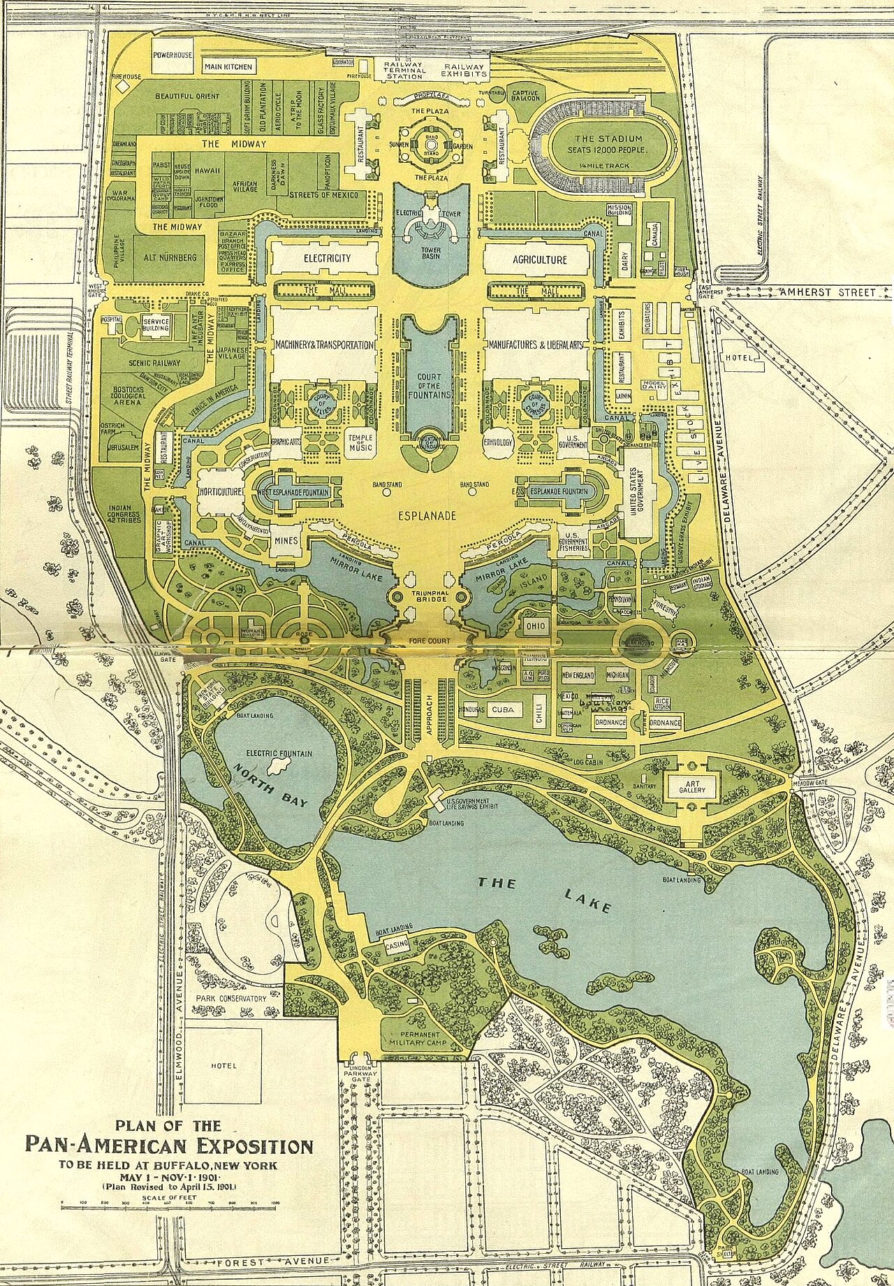
Pan-American Exposition, Buffalo (1901)Run the image installer to download
Pan-American Exposition, Buffalo (1901)Buffalo's 1901 Pan-American Exposition, lit by Niagara hydroelectric power - and cited by believers as free-energy 'Tartarian' tech.
Louisiana Purchase Exposition, St. Louis (1904)Run the image installer to download
Louisiana Purchase Exposition, St. Louis (1904)St. Louis's 1904 world's fair; most of its 1,500 buildings were temporary staff structures, removed after the fair.
Staff - the 'stone' of the world's fairsRun the image installer to download
Staff - the 'stone' of the world's fairsStaff, a mix of plaster of Paris and hemp or jute fibre cast in moulds, which let fair builders fake marble palaces in months.
Free energy from spires, domes and the aether
What believers say
Tartarians drew limitless wireless 'aetheric' power from the atmosphere. Spires, minarets, crosses and domes were antennas; cathedrals were resonators and healing sound baths. Tesla rediscovered it, so Wardenclyffe was shut down.
What the record shows
The aether was a real 19th-century hypothesis, ruled out by the Michelson-Morley experiment in 1887 and Einstein's relativity. The atmosphere has an electric field of about 100 volts per metre, but the available current is tiny. Tesla's Wardenclyffe failed because J. P. Morgan stopped funding it; it was demolished in 1917 to pay debts. Metal finials were mostly lightning rods. The fairs' famous lighting came from on-site steam power plants.
Check it yourself: Tesla's own patents and letters on Wardenclyffe are published by the Tesla Museum in Belgrade.
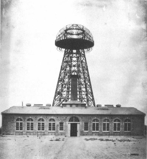
Wardenclyffe Tower (1901-1917)Run the image installer to download
Wardenclyffe Tower (1901-1917)Nikola Tesla's Wardenclyffe Tower on Long Island, meant for wireless transmission, abandoned for lack of funding and demolished in 1917.
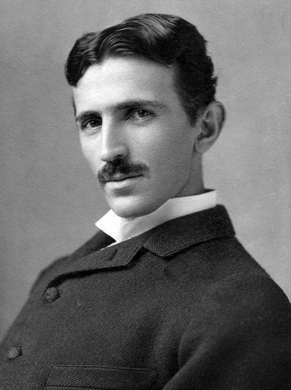
Nikola TeslaRun the image installer to download
Nikola TeslaNikola Tesla (1856-1943), whose dream of wireless power is the backbone of the 'Tartarian free energy' story.
Luminiferous aetherRun the image installer to download
Luminiferous aetherThe luminiferous aether, a 19th-century hypothesis for the medium of light, ruled out by the 1887 Michelson-Morley experiment - the 'aetheric energy' of Tartaria lore.
Atmospheric electricityRun the image installer to download
Atmospheric electricityAtmospheric electricity is real (fair-weather fields of ~100 V per metre) but delivers only tiny currents - not enough to power a city.
Lightning rodsRun the image installer to download
Lightning rodsFranklin's lightning rod (1752): the actual purpose of most metal spires and finials on tall buildings.
Electric light at the fairsRun the image installer to download
Electric light at the fairsThe 1893 fair's night illumination, powered by Westinghouse/Tesla alternating current from a steam-driven power plant on site.
The 'reset': orphan trains and incubator babies
What believers say
After the mud flood, the survivors' memories were wiped and the land repopulated. Orphan trains shipped mass-produced children west; world's-fair incubator exhibits were baby factories. Empty-street photos show depopulated cities.
What the record shows
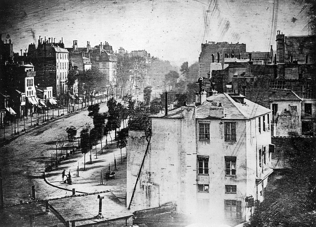
The orphan trains (1854-1929) were run by Charles Loring Brace's Children's Aid Society and Catholic charities to move about 200,000 children out of overcrowded tenements; case files, rider lists and later oral histories survive. Martin Couney's incubator shows saved premature babies when hospitals would not - thousands of survivors were documented, some attending reunions. 'Empty' streets in early photos are an artefact of long exposures: in Daguerre's 1838 Paris street image only a man having his boots shined stood still long enough to appear.
Check it yourself: The National Orphan Train Complex in Concordia, Kansas, keeps rider records and personal accounts.
Orphan trains (1854-1929)Run the image installer to download
Orphan trains (1854-1929)The orphan trains, which carried about 200,000 children from crowded eastern cities to farms in the Midwest - recast by believers as repopulating a world emptied by the mud flood.
Charles Loring BraceRun the image installer to download
Charles Loring BraceCharles Loring Brace, founder of the Children's Aid Society (1853), who started the orphan-train program.
Infant incubator exhibitsRun the image installer to download
Infant incubator exhibitsMartin Couney's premature-baby incubator shows at world's fairs and Coney Island (1896-1943) - which believers claim were 'baby factories' for a reset.
Year Without a Summer (1816)Run the image installer to download
Year Without a Summer (1816)1816, the Year Without a Summer after the Tambora eruption - one of several dates proposed for a 'reset'.
'Empty streets' in long exposuresRun the image installer to download
'Empty streets' in long exposuresDaguerre's 1838 Boulevard du Temple: the street looks deserted because moving traffic vanished during the long exposure. The same effect explains many 'empty city' photos.
Wars, fires and revolutions as cover-up
What believers say
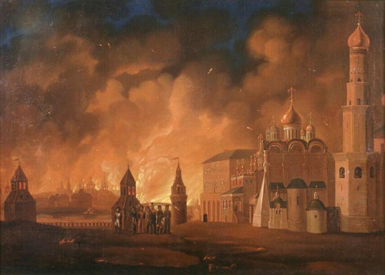
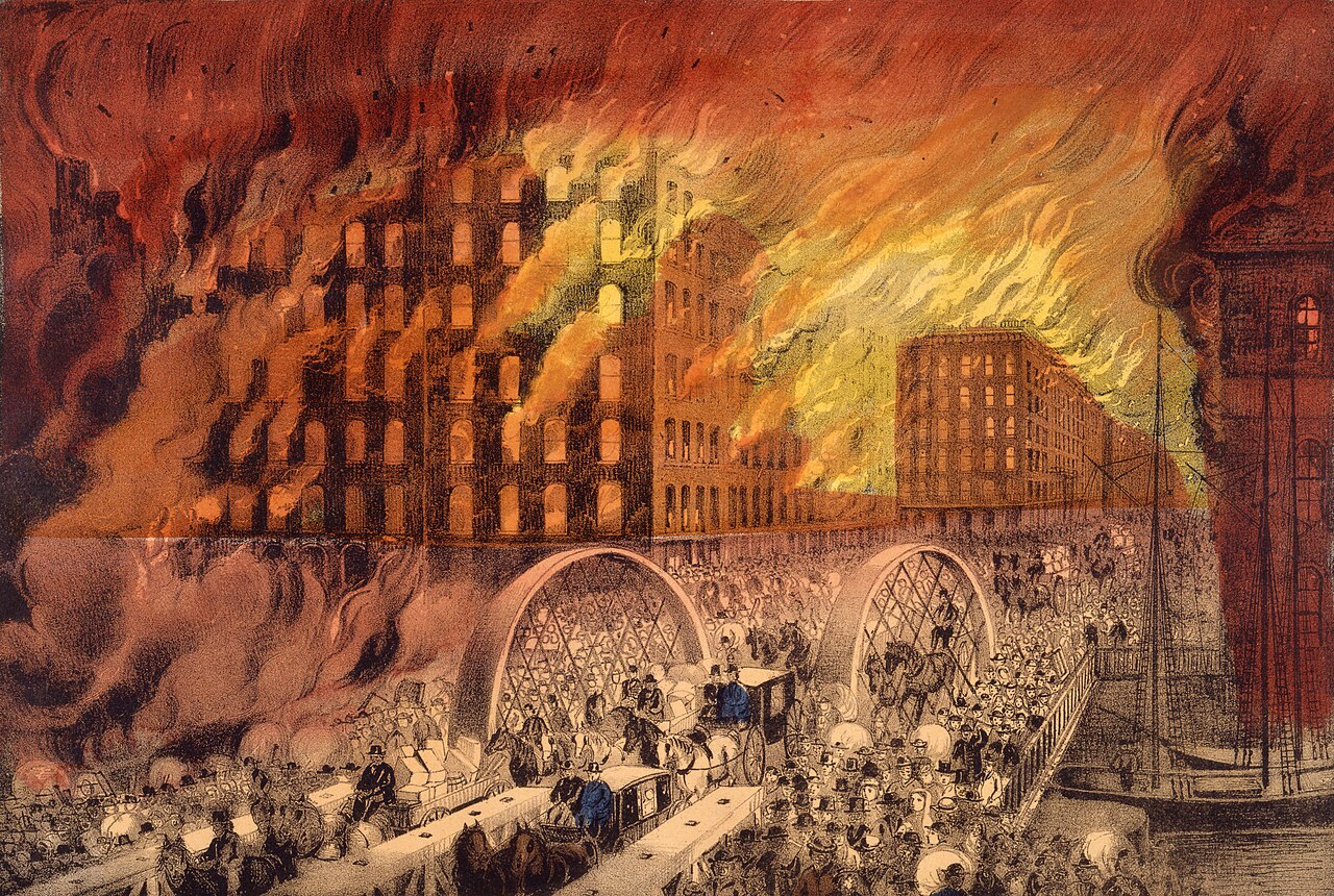
The Napoleonic wars, the 1812 Moscow fire, the great city fires of the 1800s, the World Wars and the Bolshevik revolution were deliberate campaigns to destroy Tartarian sites and records. Russian versions name Pugachev's rebellion (1773-75) or the 1812 war as the final defeat of Great Tartary.
What the record shows
These events are among the most documented in history, with independent sources on every side. 19th-century cities were wooden, gas-lit and packed together; great fires were common. WWII bombing really did destroy much historic architecture, which is partly why the claim feels plausible. Pugachev was a Don Cossack pretender to the throne, not a Tartarian emperor; his trial records survive.
Check it yourself: Compare accounts from opposing sides of the same war - erasure would need every country to agree.
Fire of Moscow (1812)Run the image installer to download
Fire of Moscow (1812)The 1812 Moscow fire during Napoleon's occupation, recast by some Russian Tartaria writers as the war that destroyed Great Tartary.
Great Chicago Fire (1871)Run the image installer to download
Great Chicago Fire (1871)The Great Chicago Fire of 1871, one of many city fires believers cite as deliberate erasure of Tartarian buildings.
Great Seattle Fire (1889)Run the image installer to download
Great Seattle Fire (1889)The Great Seattle Fire of June 1889, which burned 25 blocks and triggered the regrading of Pioneer Square.
Pugachev's Rebellion (1773-75)Run the image installer to download
Pugachev's Rebellion (1773-75)Pugachev's Rebellion, a Cossack and peasant uprising against Catherine the Great. Levashov-inspired writers recast it as the last war of Great Tartary.
The Tartarians were giants
What believers say
Huge doors, high ceilings and oversized stairs prove the builders were giants. Related 'mother tree' claims say mesas and Devils Tower are stumps of kilometre-high trees felled in the past.
What the record shows
High ceilings kept rooms cool and lit before air conditioning and electric light, and grand doors signalled status. No giant skeletons have ever been verified; famous 'finds' like the Cardiff Giant (1869) were confessed hoaxes. Devils Tower and the Giant's Causeway are cooled volcanic rock whose hexagonal columns form as lava shrinks - the same jointing seen in laboratory experiments.
Check it yourself: Ask whether any museum holds a giant skeleton you can see - none does.
NephilimRun the image installer to download
NephilimThe Nephilim of Genesis 6, the biblical giants Tartaria believers often equate with Tartarian builders.
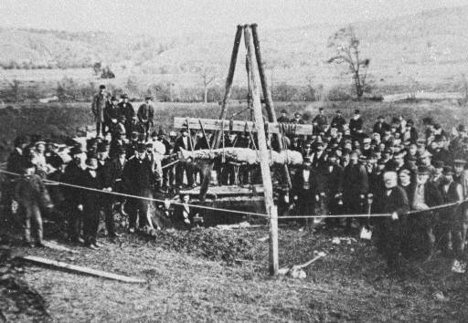
The Cardiff Giant (1869)Run the image installer to download
The Cardiff Giant (1869)The Cardiff Giant, a 10-ft gypsum statue buried and 'discovered' in New York in 1869 - one of the most famous giant hoaxes.
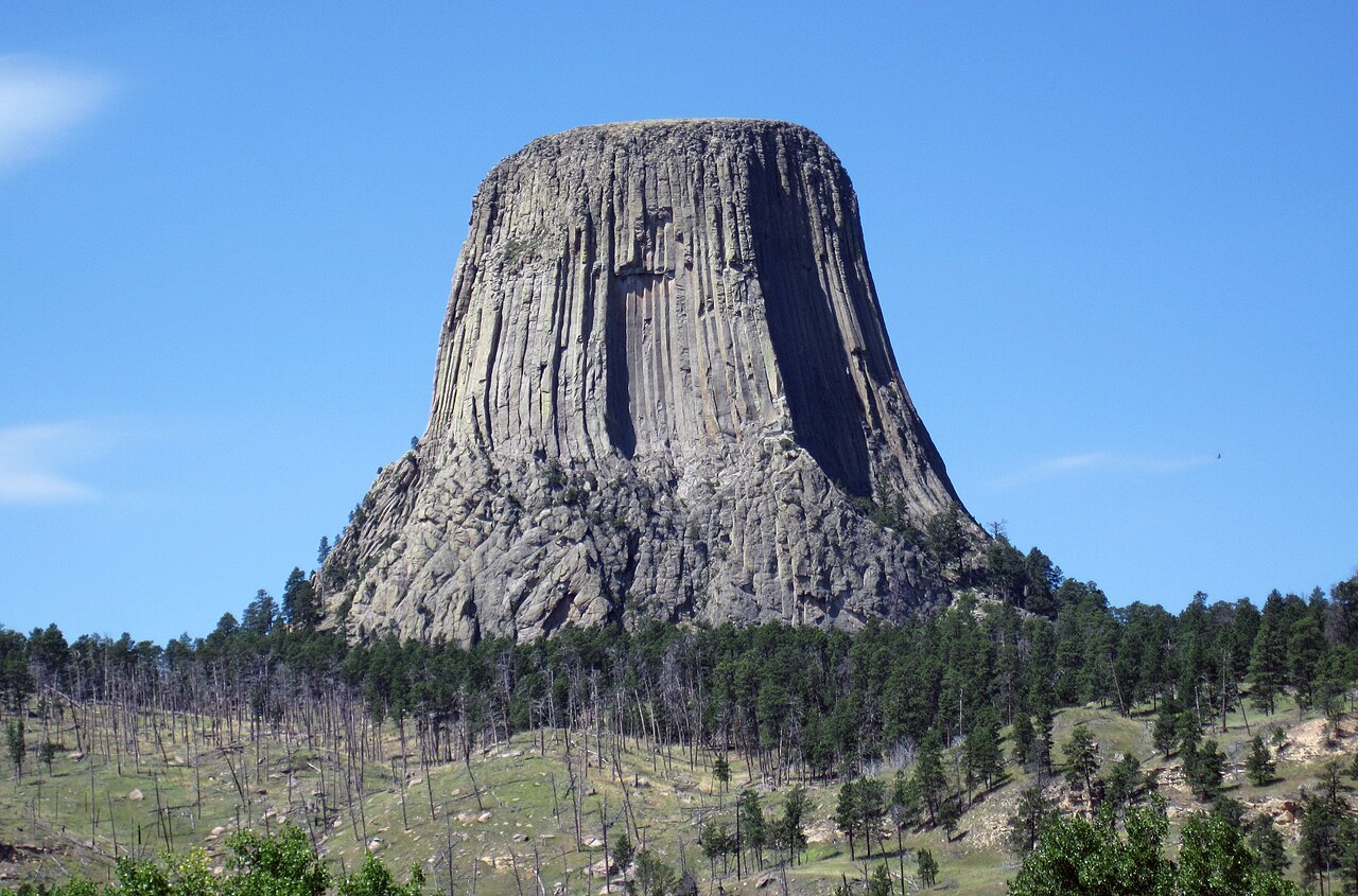
Devils Tower, WyomingRun the image installer to download
Devils Tower, WyomingDevils Tower, an igneous intrusion with columnar joints - claimed in 'mother tree' theories to be the stump of a giant petrified tree.
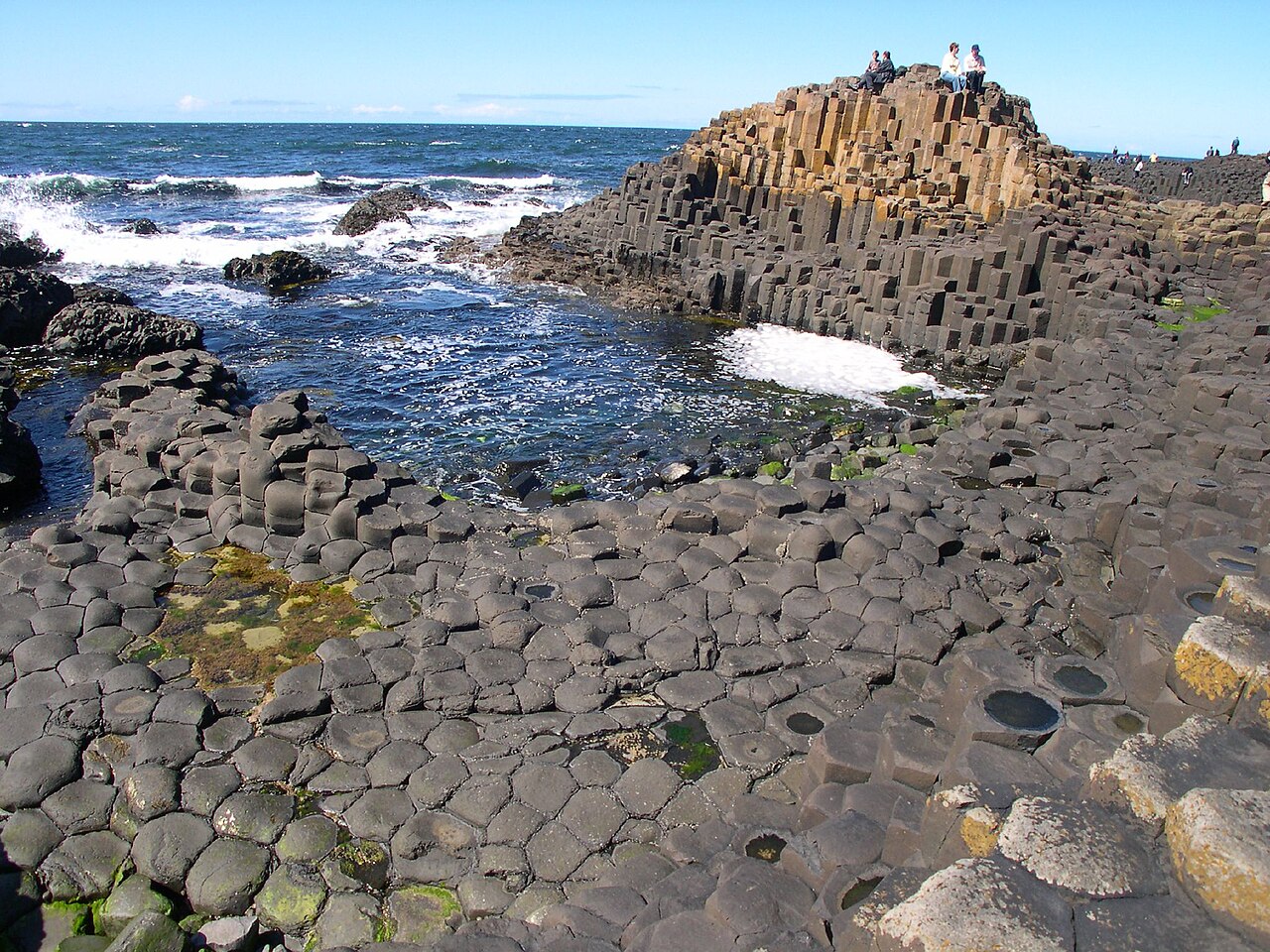
Giant's CausewayRun the image installer to download
Giant's CausewayThe Giant's Causeway in Northern Ireland, 40,000 basalt columns from volcanic cooling, said in legend to be built by the giant Finn McCool.
The maps prove a hidden empire
What believers say
Tartary is on hundreds of old maps and in the 1771 Britannica, yet schools never teach it, so it was erased. Its sudden disappearance from 19th-century maps is the cover-up.
What the record shows
Tartary was never hidden - it is on display in every map library. It was a blanket name for lands Europeans knew little about, like 'Terra Incognita'. Maps show it as one vast area with no borders (Visscher), then split into many Tartaries (de L'Isle), then replaced by real states as surveys improved (Colton, 1880s). The Britannica entry describes a geographic region with several peoples, not one empire. The Russian Geographical Society holds a collection of Tartary maps and calls the empire a myth.
Check it yourself: The Library of Congress blog 'Tracking Tartary on Western Maps' (2025) shows the full sequence.
Ortelius, Tartariae sive Magni Chami Regni (1570)Run the image installer to download
Ortelius, Tartariae sive Magni Chami Regni (1570)Abraham Ortelius's 1570 map from the Theatrum Orbis Terrarum, the first atlas map dedicated to Tartary. It shows one vast region from the Volga to the Pacific, still echoing the Mongol Empire of two centuries earlier.
Guillaume de L'Isle, Carte de TartarieRun the image installer to download
Guillaume de L'Isle, Carte de TartarieGuillaume de L'Isle's Carte de Tartarie, which splits the region into many Tartaries - Independent, Chinese, Muscovite, Little - as European information improved.
Encyclopaedia Britannica, 1st edition (1768-71)Run the image installer to download
Encyclopaedia Britannica, 1st edition (1768-71)Title page of the first Encyclopaedia Britannica. Its 1771 entry calls Tartary a vast country in northern Asia - a line widely shared online as proof of an empire.
Colton, Central Asia (1880s)Run the image installer to download
Colton, Central Asia (1880s)By the 1880s American and European maps had replaced Tartary with Turkestan, Mongolia, Manchuria and the Russian and Chinese empires.
A CIA file admits Tartaria's history was rewritten
What believers say
A declassified 1957 CIA document mentions a Soviet order for 'a scientific revision of the history of Tartaria' - proof of the cover-up.
What the record shows
The document, 'National Cultural Development Under Communism', is about Soviet treatment of Muslim peoples. 'Tartaria' there means the Tatar ASSR (today's Tatarstan). The 1944 Party directive it cites ordered historians to rewrite Tatar history in Russia's favour - real Soviet censorship of a real people, not of a global empire. The excerpt first spread through a 2018 StolenHistory post.
Check it yourself: Read the whole CIA file (CIA-RDP78-02771R000200090002-6) in the CIA reading room, not a cropped screenshot.
The older legends Tartaria borrows from
Myths & lost worlds
Long before the internet, "Tartary" was where Europe put its marvels and monsters. The modern legend recycles these older stories - some about Tartary itself, some about other lost or hidden lands.
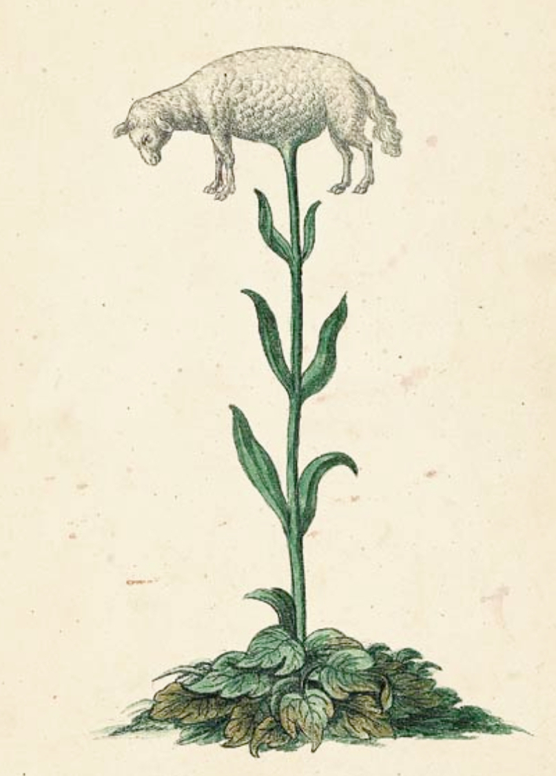
The Vegetable Lamb of TartaryRun the image installer to download
The Vegetable Lamb of TartaryThe Vegetable Lamb of Tartary (barometz): a plant said to grow live lambs, reported by Mandeville and Herberstein - probably a garbled report of cotton or the woolly fern Cibotium barometz.
The Vegetable Lamb of Tartary
A plant whose fruit was a living lamb, tethered by a stem and grazing until the grass ran out. Reported by Mandeville in the 14th century and by Herberstein, who placed it between the Volga and the Urals. Hans Sloane in 1698 traced it to the woolly rhizome of the fern Cibotium barometz; cotton, unknown to northern Europe, is the deeper root.
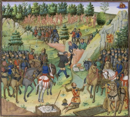
Gog and MagogRun the image installer to download
Gog and MagogGog and Magog, the apocalyptic nations walled in by Alexander. 13th-century Europeans identified the invading Mongols - the Tartars - with them.
Gog and Magog
The apocalyptic nations of Ezekiel and Revelation, and the Ya'juj and Ma'juj of the Qur'an, sealed behind a wall by Alexander (Dhu'l-Qarnayn). When the Mongols burst into Europe in 1241, chroniclers asked whether these were Gog and Magog released. Medieval maps place them in the far north-east of Tartary.
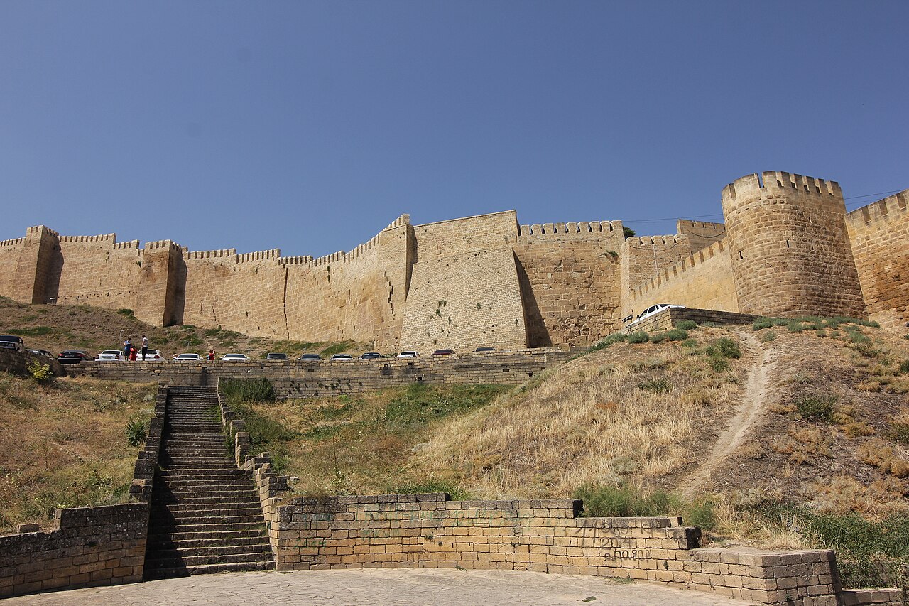
Gates of AlexanderRun the image installer to download
Gates of AlexanderThe legendary Gates of Alexander, an iron barrier against Gog and Magog, identified with the Derbent wall in the Caucasus and later with the Great Wall of China.
The Gates of Alexander
A bronze or iron gate between two mountains, holding back the unclean nations. Identified over time with the Caspian Gates, the Derbent wall (seen by Rubruck in 1254) and the Great Wall of China. The template for the idea of a hidden people walled off in Tartary.
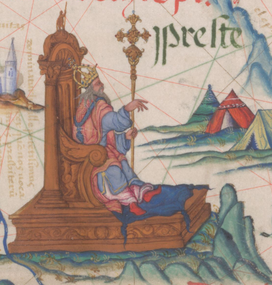
Prester JohnRun the image installer to download
Prester JohnPrester John, the imaginary Christian priest-king of the East whom Europeans hoped would rescue them from the Muslims - and later from the Tartars.
Prester John
A rich Christian priest-king of the East whom Europe hoped would attack Islam from behind. When Genghis Khan's armies appeared, some first thought he was Prester John's descendant. Flag charts of the 1700s still printed 'Prester John' flags beside 'Tartary' flags.
TartarusRun the image installer to download
TartarusTartarus, the abyss beneath Hades in Greek myth. Europeans punned Tatar into 'Tartar' - people from hell.
Tartarus
The deepest prison of Greek myth. The pun 'Tatar' to 'Tartar' turned a people into demons from the abyss - the origin of the name itself.
HyperboreaRun the image installer to download
HyperboreaHyperborea, the Greek land 'beyond the North Wind', revived by Russian esoteric writers as the polar homeland of the Aryans and of Great Tartary.
Hyperborea
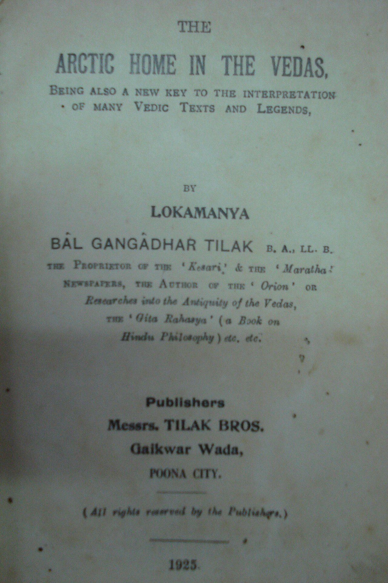
The Greek land beyond the North Wind, where the sun never set. Revived by Theosophy, by B. G. Tilak's Arctic Home in the Vedas (1903) and by Russian esoteric writers, it becomes in many Tartaria stories the polar mother-land from which Great Tartary descended. Mercator's 1595 Arctic map is its favourite image.
Mercator, Septentrionalium Terrarum (1595)Run the image installer to download
Mercator, Septentrionalium Terrarum (1595)Gerardus Mercator's 1595 map of the North Pole: four islands around a whirlpool and a black magnetic rock, Rupes Nigra. Popular in Hyperborea and Tartaria circles; based on the lost Inventio Fortunata.
Mercator's Polar Islands and Rupes Nigra
Four islands around a whirlpool at the pole with a black magnetic rock, copied by Mercator from the lost 14th-century Inventio Fortunata via Jacobus Cnoyen. The map's notes mention pygmies 4 feet tall. Shared online as a map of Hyperborea or of the Tartarian north.
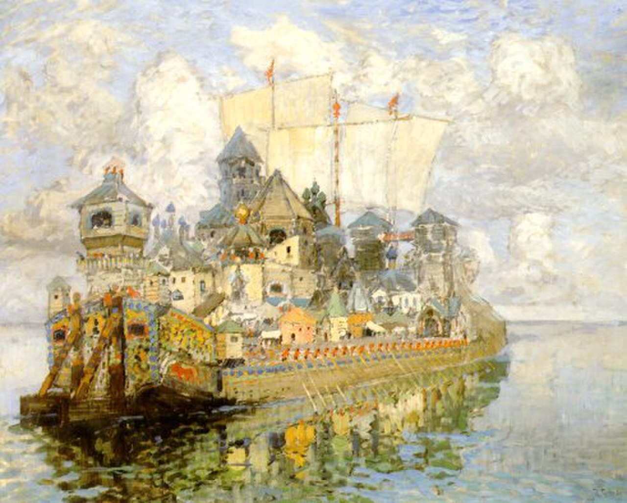
Kitezh, the drowned cityRun the image installer to download
Kitezh, the drowned cityKitezh, the Russian legendary city that sank into Lake Svetloyar to escape the Mongol-Tatar army of Batu Khan - Russia's own lost-city legend tied to the Tartars.
Kitezh
Russia's drowned holy city, which sank into Lake Svetloyar rather than fall to Batu Khan's Mongol-Tatar army in the 1200s. Pilgrims still claim to hear its bells. A genuine folk legend in which the 'Tartars' are the destroyers, not the builders.
BelovodyeRun the image installer to download
BelovodyeBelovodye, the 'White Waters', a hidden paradise in the Altai sought by Russian Old Believers.
Belovodye
The 'Kingdom of White Waters', a hidden land of righteousness in the Altai or beyond, sought by Old Believer expeditions in the 18th-19th centuries; later fused with Shambhala by Nicholas Roerich.
ShambhalaRun the image installer to download
ShambhalaShambhala, the hidden kingdom of Tibetan Kalachakra tradition, located by Theosophists in Central Asian 'Tartary'.
Shambhala
The hidden kingdom of the Kalachakra Tantra. Theosophists and Roerich placed it in the Central Asian heart of old 'Tartary'; Swedenborg (as quoted by Theosophists) told seekers to look for 'the Lost Word' among the sages of Tartary and Tibet.
AgarthaRun the image installer to download
AgarthaAgartha, the subterranean kingdom of 19th-century occultism (Saint-Yves d'Alveydre), tied to hollow-earth and Tartaria ideas.
Agartha
A subterranean world-kingdom described by Saint-Yves d'Alveydre (1886) and Ferdynand Ossendowski (1922), reached through caves in Central Asia. Shares the Tartaria motifs of an advanced hidden civilisation and suppressed knowledge.
Hollow EarthRun the image installer to download
Hollow EarthHollow Earth theories, from Edmond Halley (1692) to John Cleves Symmes, often merged with polar Hyperborea and Tartaria lore.
Hollow Earth
Halley's 1692 idea of concentric shells inside the Earth, turned into polar-opening theories by Symmes in the 1820s. Often combined with Hyperborea and Agartha in online Tartaria lore.
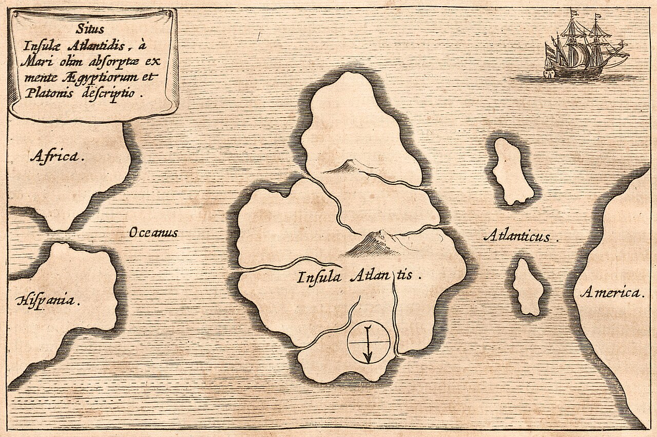
AtlantisRun the image installer to download
AtlantisAtlantis, Plato's sunken island from the Timaeus and Critias - the template for every lost advanced civilization, Tartaria included.
Atlantis
Plato's cautionary tale, inflated into history by Ignatius Donnelly in 1882. Tartaria follows the same plot: a high civilisation destroyed in a catastrophe, its survivors' achievements later credited to others.
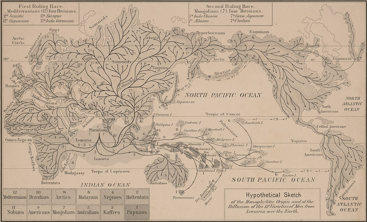
LemuriaRun the image installer to download
LemuriaLemuria, a sunken continent first proposed by zoologist Philip Sclater in 1864 to explain lemur fossils, later adopted by Theosophy.
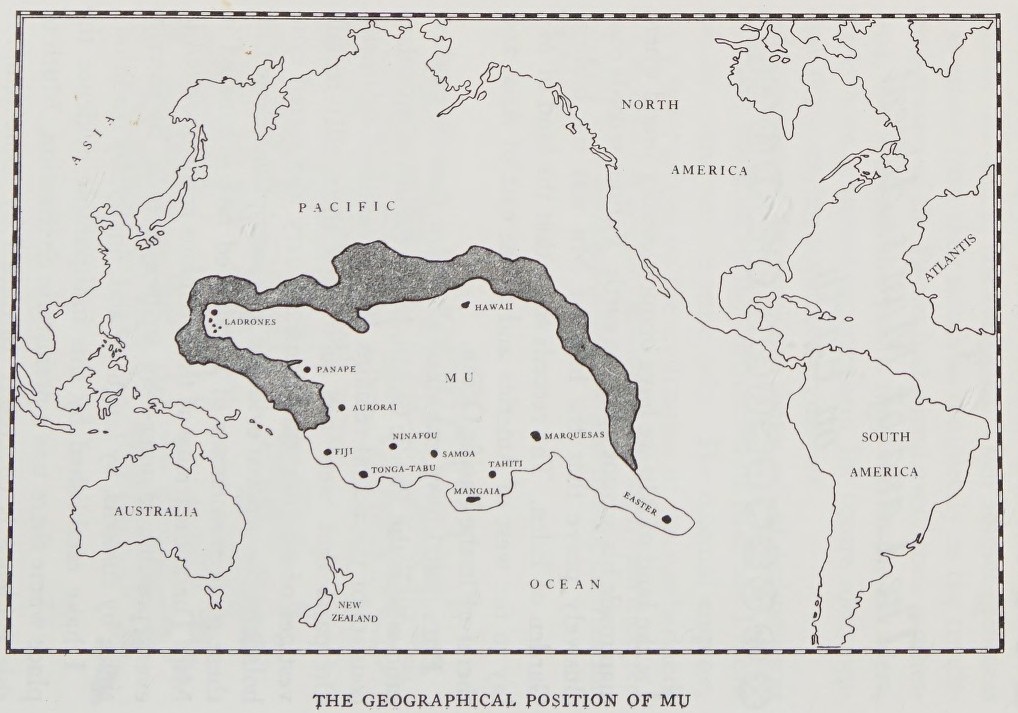
Lemuria and Mu
Sunken continents of 19th-century science (Lemuria, proposed in 1864 to explain lemur fossils before plate tectonics) and 1920s mysticism (Churchward's Mu). Theosophy made them homes of earlier 'root races'.
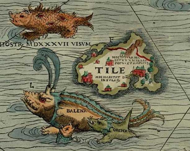
ThuleRun the image installer to download
ThuleThule, the far-northern island first reported by Pytheas around 320 BC, later mythologised by esoteric nationalists.
Thule
Pytheas's northern island, later a mystical Aryan homeland in German esotericism. Part of the same family of polar-origin myths as Hyperborea.
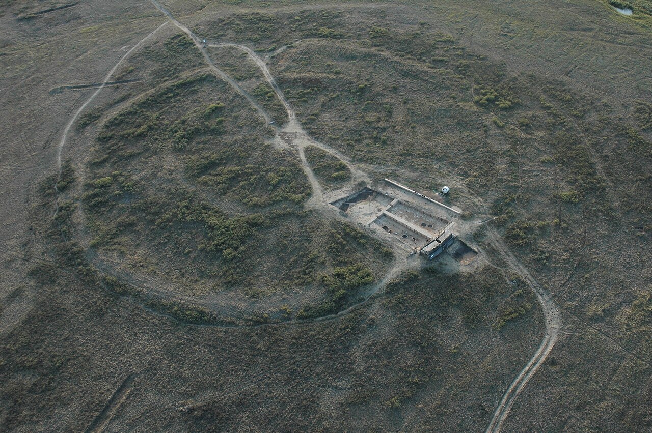
ArkaimRun the image installer to download
ArkaimArkaim, a real Bronze Age fortified settlement (c. 2000 BC) in the southern Urals, adopted by Russian neo-pagans as a 'Slavic-Aryan' capital.
Arkaim
A real Bronze Age circular settlement in the southern Urals, discovered in 1987. Russian neo-pagans and Levashov-style writers claim it as a capital of the Slavic-Aryans; archaeologists link it to the Sintashta culture, about 2000 BC.
Book of VelesRun the image installer to download
Book of VelesThe Book of Veles, supposed ancient Slavic wooden tablets, widely regarded as a 20th-century forgery - used by neo-pagan Tartaria narratives.
The Book of Veles
Wooden boards supposedly carved by ancient Slavic priests, known only from 20th-century copies. Scholars consider it a forgery; it remains a core text for Slavic-Aryan and Tartaria narratives.
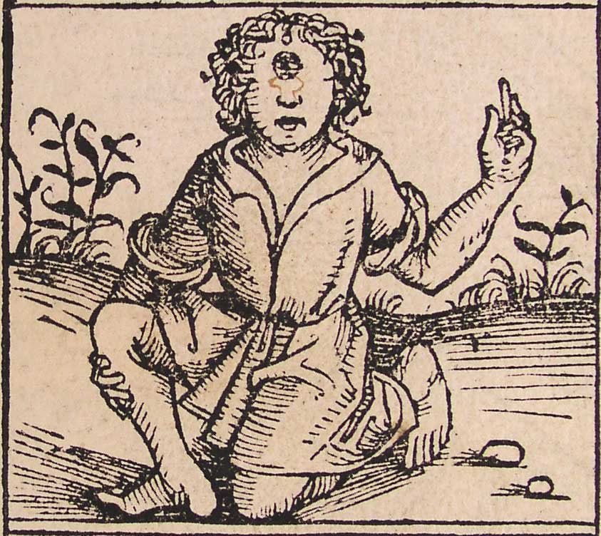
Griffins and the ArimaspiRun the image installer to download
Griffins and the ArimaspiThe one-eyed Arimaspi who fought gold-guarding griffins in Herodotus's Scythia - Central Asia's original monsters.
Griffins and Arimaspi
Herodotus's report of gold-guarding griffins and one-eyed Arimaspi in Scythia. Possibly inspired by Protoceratops fossils in the Gobi and real gold mining in the Altai - Central Asia's first lost-world legend.
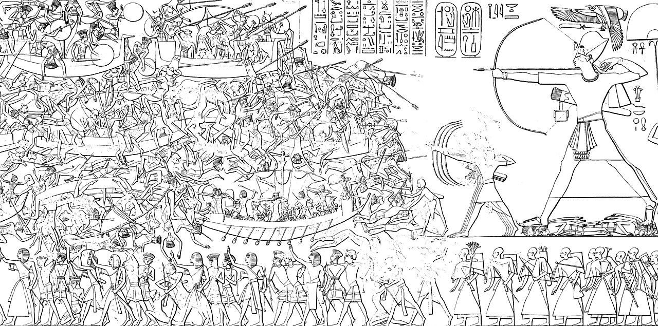
Sea PeoplesRun the image installer to download
Sea PeoplesThe Sea Peoples of the Late Bronze Age collapse - a real lost-civilization episode, unlike Tartaria.
The Sea Peoples
A real collapse: around 1200-1150 BC, raiders hit Egypt and the Levant as Bronze Age kingdoms fell. Shows what a genuine lost civilisation leaves behind - ruins, burnt layers and records from its enemies.
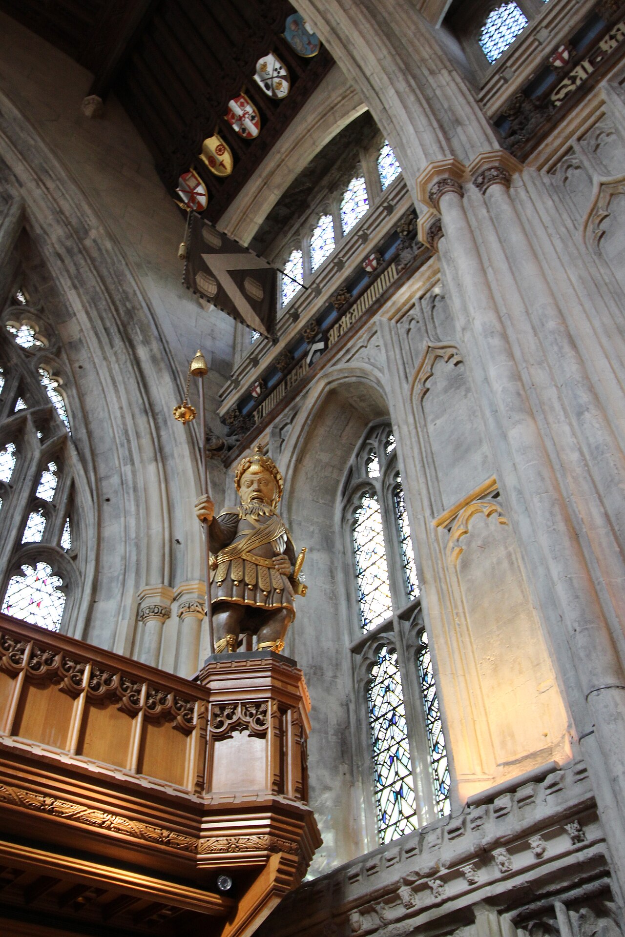
Gog and Magog, Guildhall LondonRun the image installer to download
Gog and Magog, Guildhall LondonThe carved giants Gog and Magog, guardians of the City of London at the Guildhall.
The Arctic Home in the Vedas (1903)Run the image installer to download
The Arctic Home in the Vedas (1903)B. G. Tilak's 1903 book claiming the Vedic Aryans came from the Arctic - a source for Hyperborea-Tartaria syntheses.
Theorists, travellers and mapmakers
People
Anatoly FomenkoRun the image installer to download
Anatoly FomenkoAnatoly Fomenko, Moscow State University mathematician and author of the New Chronology, which claims a Russian-Turkic 'Horde' ruled Eurasia as Great Tartary.
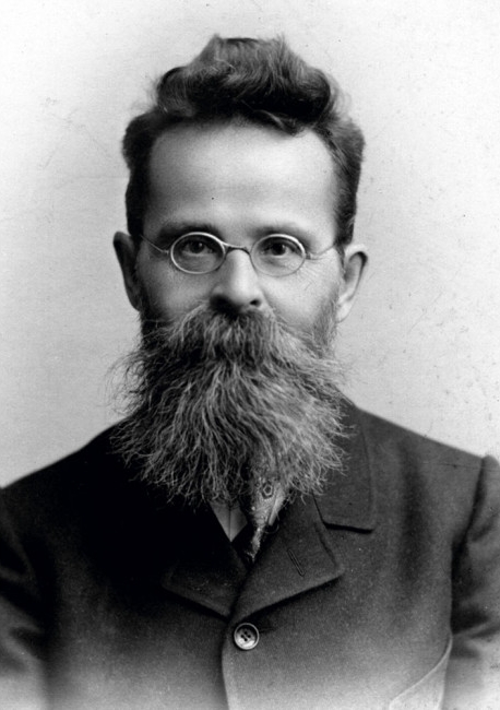
Nikolai MorozovRun the image installer to download
Nikolai MorozovNikolai Morozov (1854-1946), revolutionary and scientist whose radical re-dating of ancient history inspired Fomenko.
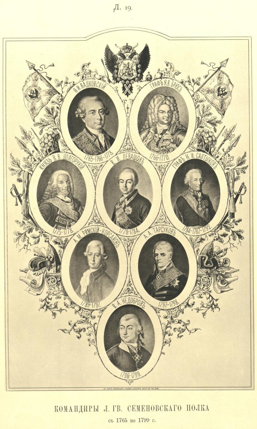
Jean HardouinRun the image installer to download
Jean HardouinJean Hardouin (1646-1729), Jesuit scholar who claimed most classical literature was forged by medieval monks - an early precursor of New Chronology.
Nikolai LevashovRun the image installer to download
Nikolai LevashovNikolai Levashov (1961-2012), Russian occultist whose books on a Slavic-Aryan empire, also called Great Tartaria, seeded much of the modern legend.
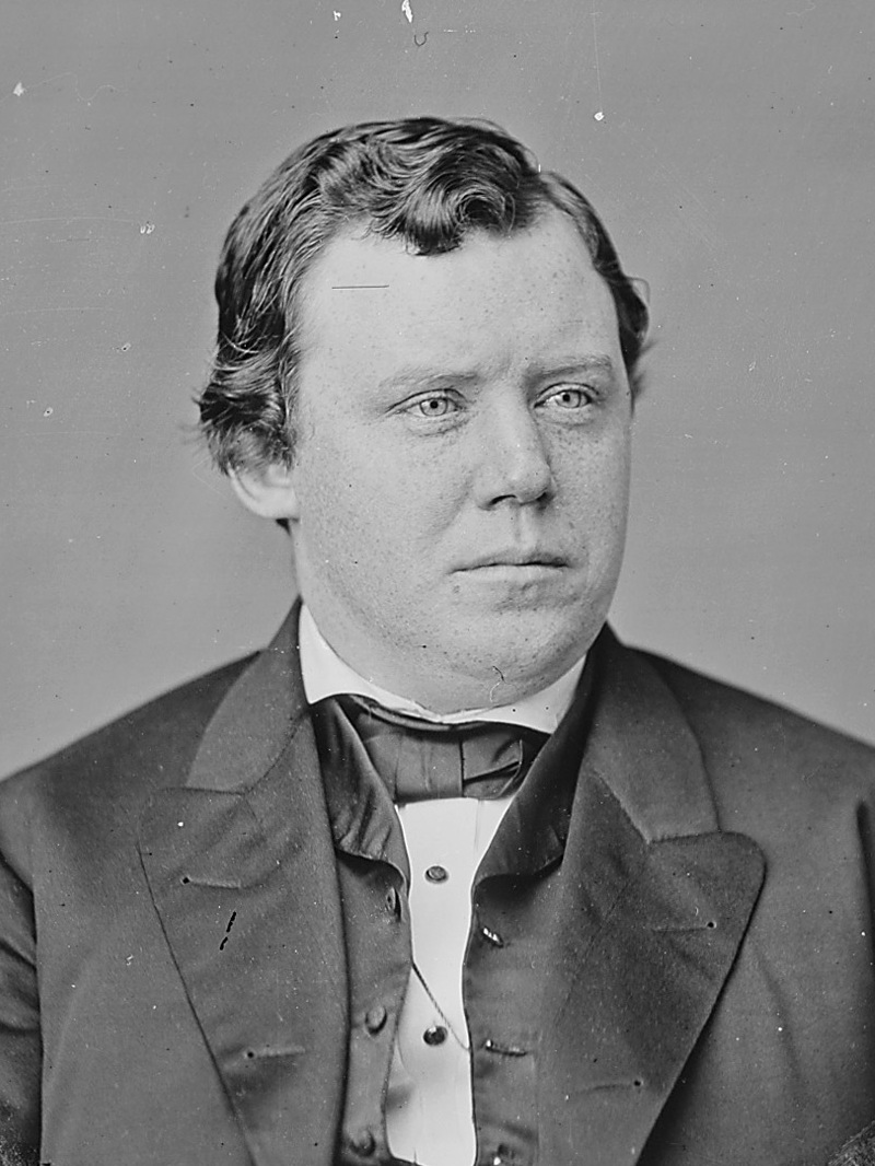
Ignatius DonnellyRun the image installer to download
Ignatius DonnellyIgnatius Donnelly, Minnesota congressman whose 1882 Atlantis: The Antediluvian World created the modern lost-civilization genre.
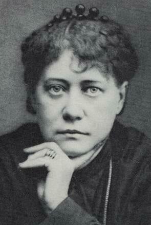
Helena BlavatskyRun the image installer to download
Helena BlavatskyHelena Blavatsky, founder of Theosophy, whose 'root races' of Hyperborea, Lemuria and Atlantis shaped later lost-empire stories.
Sir John MandevilleRun the image installer to download
Sir John Mandeville'Sir John Mandeville', the probably fictional author of a hugely popular 14th-century travel book full of Tartar marvels.
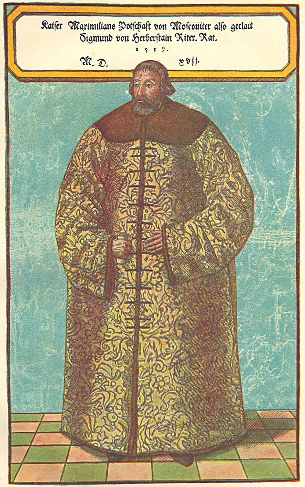
Sigismund von HerbersteinRun the image installer to download
Sigismund von HerbersteinHabsburg diplomat Sigismund von Herberstein, whose 1549 Notes on Muscovite Affairs described Russia, the Tartars and the Vegetable Lamb.
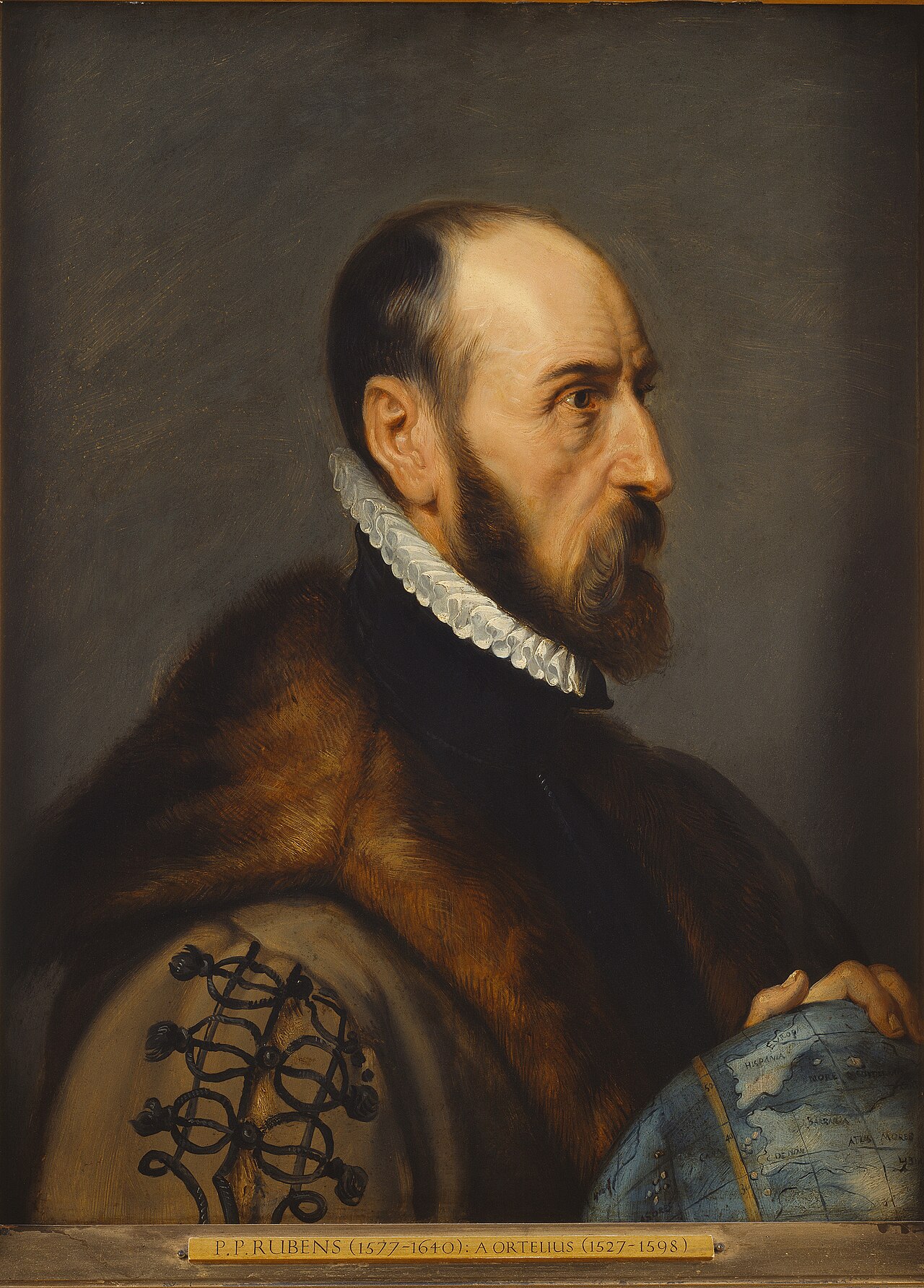
Abraham OrteliusRun the image installer to download
Abraham OrteliusAbraham Ortelius, Flemish creator of the first modern atlas (1570), which spread the single giant 'Tartaria' across Europe.
Every file, where it lives, who made it
Image index & credits
All images come from Wikimedia Commons and Wikipedia, mostly public domain or Creative Commons. The installer records each file's author, licence and source page in images/credits.js, images/credits.json and a .txt card next to each image; this table fills in automatically.
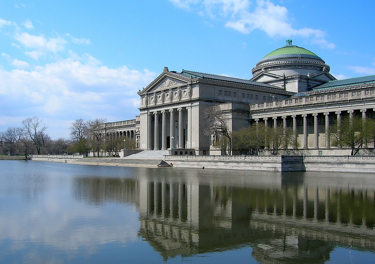
Palace of Fine Arts, Chicago (Museum of Science and Industry)Run the image installer to download
Palace of Fine Arts, Chicago (Museum of Science and Industry)The 1893 fair's Palace of Fine Arts, rebuilt in permanent stone in the 1930s as Chicago's Museum of Science and Industry.
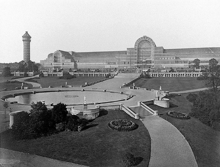
The Crystal Palace, London (1851)Run the image installer to download
The Crystal Palace, London (1851)Joseph Paxton's iron-and-glass Crystal Palace for the 1851 Great Exhibition, destroyed by fire in 1936.
Hagia SophiaRun the image installer to download
Hagia SophiaHagia Sophia in Istanbul (537 AD), claimed online to extend many storeys underground as a buried energy building.
Taj MahalRun the image installer to download
Taj MahalThe Taj Mahal (1632-1653), built for Shah Jahan by a documented workforce - frequently listed as Tartarian.
PetraRun the image installer to download
PetraPetra, the Nabataean rock-cut city in Jordan, attributed by some believers to a giant Tartarian race.
Beaux-Arts architectureRun the image installer to download
Beaux-Arts architectureThe Beaux-Arts style taught at the Ecole des Beaux-Arts in Paris and exported worldwide - the real reason so many city halls and stations look alike.
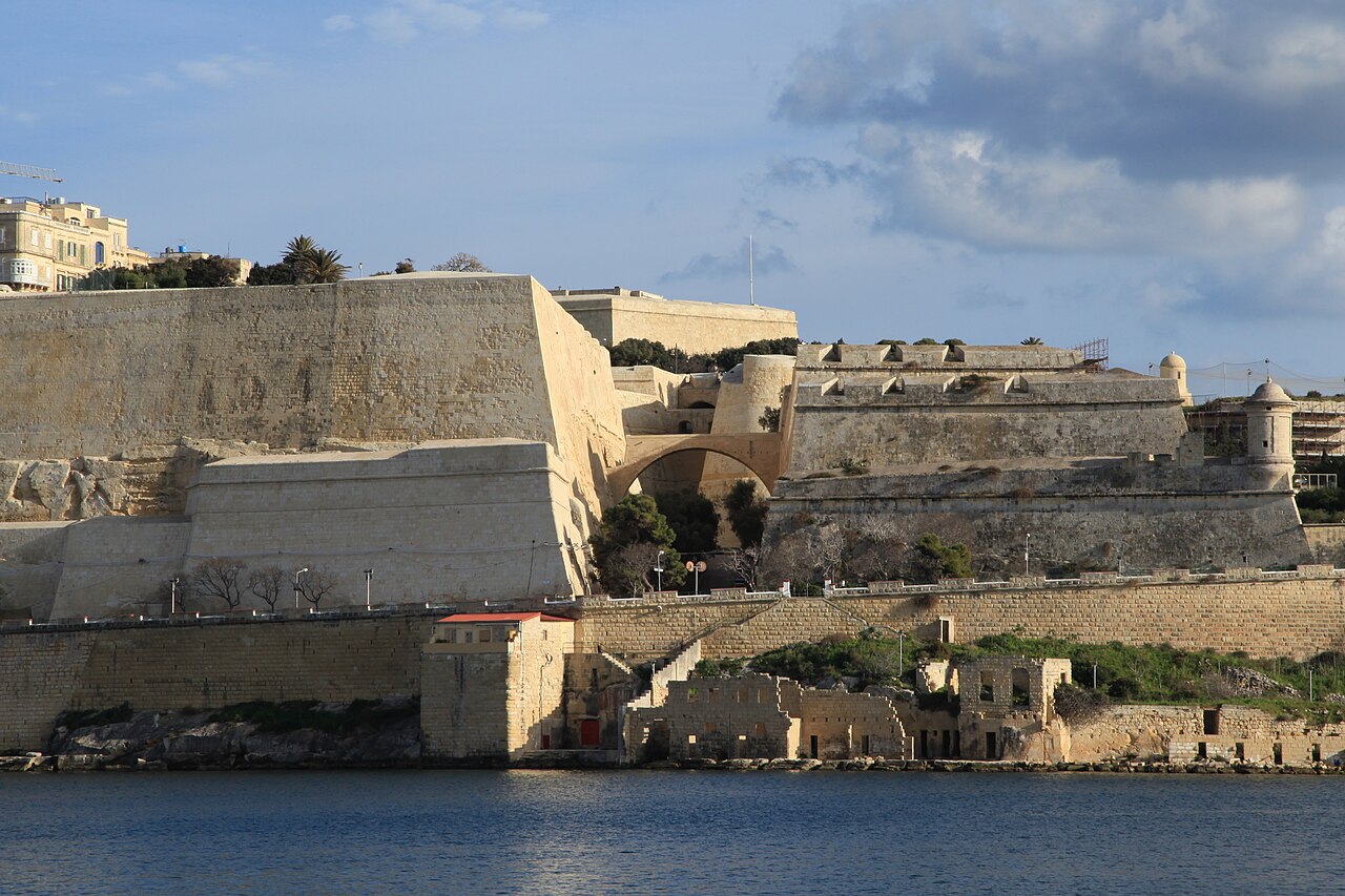
Fortifications of Valletta, MaltaRun the image installer to download
Fortifications of Valletta, MaltaValletta's bastions, built by the Knights of St John after the Great Siege of 1565.
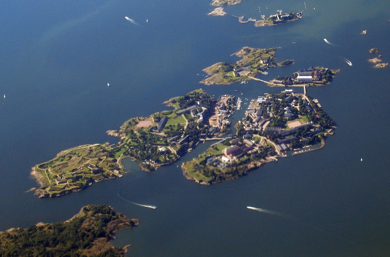
Suomenlinna, HelsinkiRun the image installer to download
Suomenlinna, HelsinkiSuomenlinna, an island sea fortress begun by Sweden in 1748 off Helsinki.
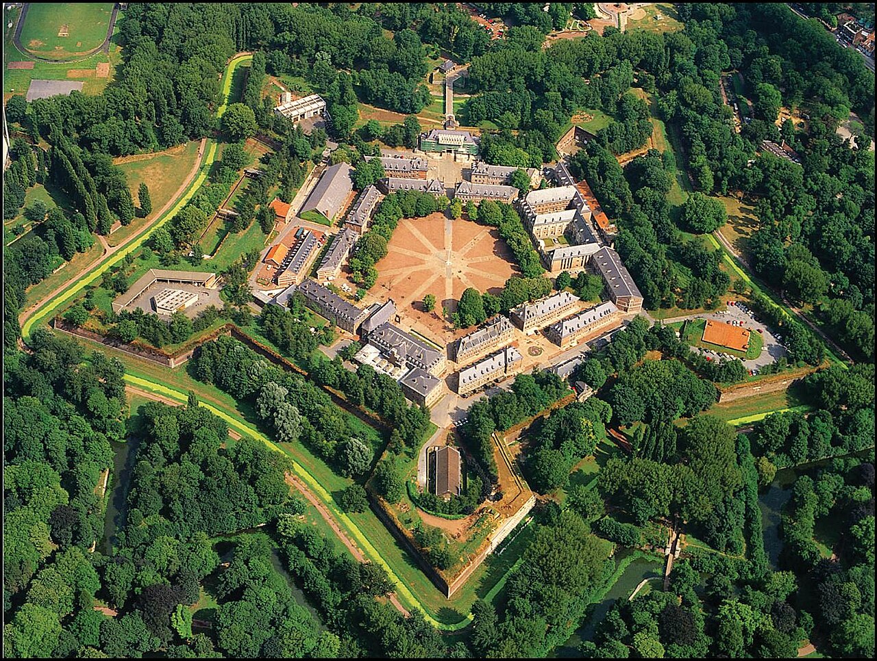
Citadel of LilleRun the image installer to download
Citadel of LilleVauban's Citadel of Lille (1667-1670), the 'queen of citadels', a textbook pentagonal star.
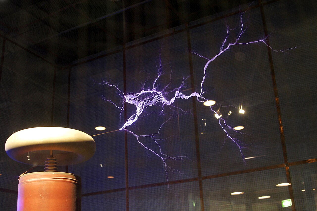
Tesla coilRun the image installer to download
Tesla coilA Tesla coil, a resonant transformer producing high-voltage sparks - real physics often conflated with spires and domes as 'antennas'.
MuRun the image installer to download
MuMu, the Pacific lost continent popularised by James Churchward in the 1920s.